Area Overview for EX11 1JP
Photos of EX11 1JP
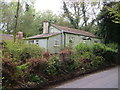
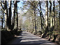
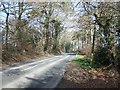
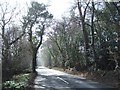
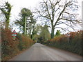
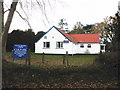
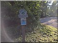
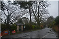
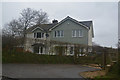

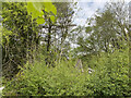
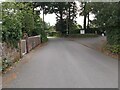
19 photos from this area
Area Information
Key information about the EX11 1JP including its size, population, and administrative classification.
- Area Type
- Postcode
- Area Size
- 5.4 hectares
- Population
- 1715
- Population Density
- 132 people/km²
House Prices in EX11 1JP
16
Properties
£468,500
Average Sold Price
£270,000
Lowest Price
£759,000
Highest Price
Showing 16 properties
| Address | Type | Beds | Baths | Last Sale Price | Last Sale Date | |
|---|---|---|---|---|---|---|
| Hunters Lodge, Windmill Lane, West Hill, EX11 1JP | Detached | 4 | 2 | £590,000 | Dec 2024 | |
| The Old Stable, Windmill Lane, West Hill, EX11 1JP | Semi-detached | 4 | 2 | £635,000 | Oct 2023 | |
| Oakleigh House, Windmill Lane, West Hill, EX11 1JP | Detached | 4 | 4 | £759,000 | Jul 2023 | |
| Thrushes Anvil, Windmill Lane, West Hill, EX11 1JP | Detached | 5 | 2 | £415,000 | Feb 2014 | |
| Four Seasons, Windmill Lane, West Hill, EX11 1JP | house | - | - | £417,500 | Jun 2013 | |
| Felcourt, Windmill Lane, West Hill, EX11 1JP | Detached | 3 | 2 | £295,000 | May 2012 | |
| The Coach House, Windmill Lane, West Hill, EX11 1JP | Semi-detached | 4 | 1 | £365,000 | Sep 2007 | |
| Beech House, 9 Windmill Lane, West Hill, EX11 1JP | Detached | - | - | £470,000 | Apr 2004 | |
| 5 Windmill Lane, West Hill, EX11 1JP | Detached | 2 | - | £270,000 | Jun 2001 | |
| Hasta La Vista, Windmill Lane, West Hill, EX11 1JP | Detached | 5 | 2 | - | - |
Page 1 of 2
Energy Efficiency in EX11 1JP
Amenities
Schools
| Rank | School | Type | Entry gender | Ages |
|---|
Explore more schools in this area
Go to Schools tabDemographics
Household Size
Two person
most common
Accommodation Type
Houses
most common
Tenure
87
majority
Ethnic Group
White
most common
Religion
N/A
most common
Household Composition
N/A
most common
Age
47
median
Adults (30-64 years)
most common
Household Deprivation
N/A
with no deprivation
NS-SEC
49
in Lower managerial occupations
Explore more demographic insights in this area
Go to Demographics tabPlanning
Planning Constraints
- Flood RiskPremium
- Ramsar Wetland SitesPremium
- Area of Outstanding Natural BeautyPremium
- Protected Nature ReservePremium
- Protected WoodlandPremium