Area Overview for EX10 9SN
Photos of EX10 9SN
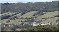
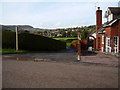
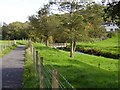
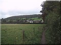
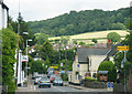
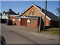
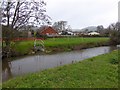
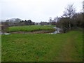

100 photos from this area
Area Information
Key information about the EX10 9SN including its size, population, and administrative classification.
- Area Type
- Postcode
- Area Size
- 1.0 hectares
- Population
- 1773
- Population Density
- 2550 people/km²
House Prices in EX10 9SN
13
Properties
£455,389
Average Sold Price
£302,500
Lowest Price
£625,000
Highest Price
Showing 13 properties
| Address | Type | Beds | Baths | Last Sale Price | Last Sale Date | |
|---|---|---|---|---|---|---|
| 27 Sidford High Street, Sidford, EX10 9SN | Retail | 4 | 2 | £625,000 | Dec 2022 | |
| 15 Sidford High Street, Sidford, EX10 9SN | Semi-detached | 3 | 1 | £302,500 | Nov 2020 | |
| 25 Sidford High Street, Sidford, EX10 9SN | house | - | - | £456,000 | Oct 2020 | |
| 33 Sidford High Street, Sidford, EX10 9SN | Detached | 5 | 5 | £475,000 | Dec 2019 | |
| 21 Sidford High Street, Sidford, EX10 9SN | house | - | - | £600,000 | Mar 2017 | |
| 31 Sidford High Street, Sidford, EX10 9SN | house | - | - | £435,000 | Jul 2016 | |
| 23 Sidford High Street, Sidford, EX10 9SN | house | 4 | - | £365,000 | Mar 2012 | |
| 29 Sidford High Street, Sidford, EX10 9SN | house | - | - | £395,000 | May 2010 | |
| 19 Sidford High Street, Sidford, EX10 9SN | Detached | - | - | £445,000 | Jul 2003 | |
| 23A Sidford High Street, Sidford, EX10 9SN | Bungalow | 4 | 4 | - | - |
Page 1 of 2
Energy Efficiency in EX10 9SN
Amenities
Schools
| Rank | School | Type | Entry gender | Ages |
|---|
Explore more schools in this area
Go to Schools tabDemographics
Household Size
Two person
most common
Accommodation Type
Houses
most common
Tenure
77
majority
Ethnic Group
White
most common
Religion
N/A
most common
Household Composition
N/A
most common
Age
47
median
Elderly (65+ years)
most common
Household Deprivation
N/A
with no deprivation
NS-SEC
33
in Lower managerial occupations
Explore more demographic insights in this area
Go to Demographics tabPlanning
Planning Constraints
- Flood RiskPremium
- Ramsar Wetland SitesPremium
- Area of Outstanding Natural BeautyPremium
- Protected Nature ReservePremium
- Protected WoodlandPremium