Area Overview for EX10 9NP
Photos of EX10 9NP
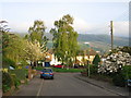
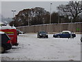
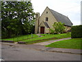
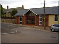
99 photos from this area
Area Information
Key information about the EX10 9NP including its size, population, and administrative classification.
- Area Type
- Postcode
- Area Size
- 7436 m²
- Population
- 1583
- Population Density
- 1201 people/km²
House Prices in EX10 9NP
10
Properties
£277,875
Average Sold Price
£85,000
Lowest Price
£555,000
Highest Price
Showing 10 properties
| Address | Type | Beds | Baths | Last Sale Price | Last Sale Date | |
|---|---|---|---|---|---|---|
| 32 Newlands Close, Sidmouth, EX10 9NP | Bungalow | 3 | 2 | £555,000 | Aug 2024 | |
| 36 Newlands Close, Sidmouth, EX10 9NP | Bungalow | 2 | - | £345,000 | Oct 2016 | |
| 46 Newlands Close, Sidmouth, EX10 9NP | Bungalow | 2 | 1 | £303,000 | Jan 2015 | |
| 42 Newlands Close, Sidmouth, EX10 9NP | Bungalow | 2 | - | £290,000 | Jan 2014 | |
| 40 Newlands Close, Sidmouth, EX10 9NP | Bungalow | 2 | - | £297,500 | Dec 2013 | |
| 30 Newlands Close, Sidmouth, EX10 9NP | Detached | - | - | £242,500 | Jul 2002 | |
| 44 Newlands Close, Sidmouth, EX10 9NP | Detached | - | - | £105,000 | Sep 1999 | |
| 48 Newlands Close, Sidmouth, EX10 9NP | Detached | - | - | £85,000 | Mar 1997 | |
| 34 Newlands Close, Sidmouth, EX10 9NP | Detached | - | - | - | - | |
| 38 Newlands Close, Sidmouth, EX10 9NP | Detached | - | - | - | - |
Energy Efficiency in EX10 9NP
Amenities
Schools
| Rank | School | Type | Entry gender | Ages |
|---|
Explore more schools in this area
Go to Schools tabDemographics
Household Size
Two person
most common
Accommodation Type
Houses
most common
Tenure
83
majority
Ethnic Group
White
most common
Religion
N/A
most common
Household Composition
N/A
most common
Age
47
median
Elderly (65+ years)
most common
Household Deprivation
N/A
with no deprivation
NS-SEC
40
in Lower managerial occupations
Explore more demographic insights in this area
Go to Demographics tabPlanning
Planning Constraints
- Flood RiskPremium
- Ramsar Wetland SitesPremium
- Area of Outstanding Natural BeautyPremium
- Protected Nature ReservePremium
- Protected WoodlandPremium