Area Overview for EX10 9LF
Photos of EX10 9LF
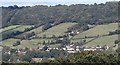
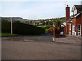
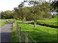
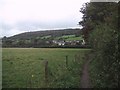
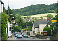
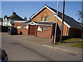
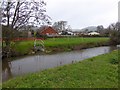
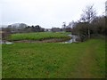
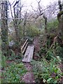
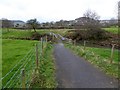
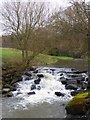

100 photos from this area
Area Information
Key information about the EX10 9LF including its size, population, and administrative classification.
- Area Type
- Postcode
- Area Size
- 1.3 hectares
- Population
- 1638
- Population Density
- 3137 people/km²
House Prices in EX10 9LF
24
Properties
£353,371
Average Sold Price
£90,500
Lowest Price
£610,000
Highest Price
Showing 24 properties
| Address | Type | Beds | Baths | Last Sale Price | Last Sale Date | |
|---|---|---|---|---|---|---|
| 56 Primley Road, Sidmouth, EX10 9LF | Semi-detached | 5 | 3 | £610,000 | May 2024 | |
| 48 Primley Road, Sidmouth, EX10 9LF | Semi-detached | 3 | 1 | £405,000 | Oct 2023 | |
| 40 Primley Road, Sidmouth, EX10 9LF | house | 4 | 2 | £597,000 | Oct 2022 | |
| 45 Primley Road, Sidmouth, EX10 9LF | Semi-detached | 4 | 1 | £455,000 | Jul 2022 | |
| 57 Primley Road, Sidmouth, EX10 9LF | house | - | - | £435,000 | Aug 2020 | |
| 41 Primley Road, Sidmouth, EX10 9LF | Semi-detached | 4 | 3 | £480,000 | Jul 2018 | |
| 42 Primley Road, Sidmouth, EX10 9LF | Detached | 3 | - | £485,000 | Jul 2015 | |
| 58 Primley Road, Sidmouth, EX10 9LF | Semi-detached | 3 | - | £280,000 | Mar 2013 | |
| 43 Primley Road, Sidmouth, EX10 9LF | Bungalow | - | - | £290,500 | Dec 2010 | |
| 54 Primley Road, Sidmouth, EX10 9LF | Semi-detached | - | - | £316,000 | May 2005 |
Page 1 of 3
Energy Efficiency in EX10 9LF
Amenities
Schools
| Rank | School | Type | Entry gender | Ages |
|---|
Explore more schools in this area
Go to Schools tabDemographics
Household Size
Two person
most common
Accommodation Type
Houses
most common
Tenure
69
majority
Ethnic Group
White
most common
Religion
N/A
most common
Household Composition
N/A
most common
Age
47
median
Adults (30-64 years)
most common
Household Deprivation
N/A
with no deprivation
NS-SEC
33
in Lower managerial occupations
Explore more demographic insights in this area
Go to Demographics tabPlanning
Planning Constraints
- Flood RiskPremium
- Ramsar Wetland SitesPremium
- Area of Outstanding Natural BeautyPremium
- Protected Nature ReservePremium
- Protected WoodlandPremium