Area Overview for EX10 9HA
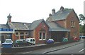
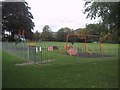
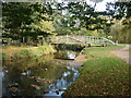
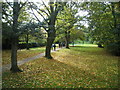
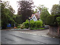
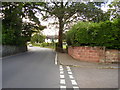
Photos of EX10 9HA
Area Information
Living in EX10 9HA offers a quiet, compact residential experience in a small cluster of homes. With a population of 1,788 and a density of 758 people per square kilometre, the area balances intimacy with sufficient space. The postcode is part of a low-density, house-dominated landscape, reflecting a community that prioritises private living over high-rise development. Daily life here is characterised by proximity to essential services and a demographic skewed towards older residents, with a median age of 47 and a significant proportion of those aged 65 and over. The area’s small size means neighbours are likely to know one another, fostering a close-knit environment. While it lacks the vibrancy of larger towns, its simplicity appeals to those seeking a calm, stable place to live. The absence of major infrastructure or transport hubs means it is ideal for retirees or those who prefer a slower pace, though it may not suit commuters reliant on frequent public transport. The area’s charm lies in its straightforwardness: no sprawling estates, no overcrowded streets, just homes and a community that values quietude.
- Area Type
- Postcode
- Area Size
- Not available
- Population
- 1788
- Population Density
- 758 people/km²
The property market in EX10 9HA is largely owner-occupied, with 85% of homes owned by their residents rather than rented out. This high rate of home ownership suggests a stable, long-term community with limited turnover. The accommodation type is exclusively houses, which is unusual for a small postcode area but reflects the low-density, residential character of the region. This means the housing stock is unlikely to include flats or apartments, making it more suited to families or individuals seeking larger living spaces. For buyers, this presents a straightforward market: properties are likely to be in private hands, reducing competition from landlords or investment firms. However, the small size of the area means the pool of available homes is limited, and buyers may need to consider nearby regions for more options. The predominance of houses also implies that properties may be more expensive per square metre compared to areas with mixed housing types, though this depends on local demand and broader market trends.
House Prices in EX10 9HA
No properties found in this postcode.
Energy Efficiency in EX10 9HA
The lifestyle in EX10 9HA is shaped by its proximity to retail amenities, including Lidl Sidmouth, Spar, and Waitrose Sidmouth. These stores provide access to groceries, household goods, and other essentials, reducing the need for long trips to larger towns. The presence of multiple retail outlets within practical reach enhances convenience, particularly for those who prefer to shop locally. While the area lacks larger leisure or entertainment venues, the retail options contribute to a functional daily life. The absence of parks, dining establishments, or cultural facilities in the data suggests that residents may need to travel to nearby towns for these amenities. However, the availability of essential shops and the low population density create a relaxed, self-contained environment. For those prioritising ease of access to basic services, the retail options in EX10 9HA are a practical advantage.
Amenities
Schools
The nearest school to EX10 9HA is Sidmouth Church of England (VA) Primary School, a primary institution with an Ofsted rating of ‘good’. This single school serves the local community, offering education for younger children. The absence of secondary schools or additional educational institutions within the area means families may need to travel to nearby towns for further schooling. However, the primary school’s ‘good’ rating indicates a satisfactory standard of education, which is a positive factor for parents prioritising quality in early years’ learning. The school’s presence also contributes to the area’s community feel, acting as a focal point for local families. For those considering EX10 9HA, the availability of a well-rated primary school is a key consideration, though parents should plan for secondary education elsewhere.
| Rank | School | Type | Entry gender | Ages |
|---|
Explore more schools in this area
Go to Schools tabDemographics
The demographic profile of EX10 9HA is defined by its older population, with 65+ year-olds forming the largest age group. The median age of 47 suggests a community where many residents are either retired or nearing retirement. Home ownership is high at 85%, indicating a strong presence of long-term residents who have invested in their properties. The accommodation type is predominantly houses, which aligns with the area’s low-density layout. The predominant ethnic group is White, reflecting a lack of ethnic diversity. While the data does not provide specific figures on deprivation, the high home ownership rate and age profile suggest a population with relatively stable incomes and limited exposure to economic hardship. This demographic structure means the area is likely to have a quieter, more sedate atmosphere, with fewer young families or transient residents. The absence of significant deprivation data implies that quality of life is not under threat from socioeconomic challenges, though this should be considered in conjunction with other factors like access to services.
Household Size
Accommodation Type
Tenure
Ethnic Group
Religion
Household Composition
Age
Household Deprivation
NS-SEC
Explore more demographic insights in this area
Go to Demographics tabPlanning
Planning Constraints
- Flood RiskPremium
- Ramsar Wetland SitesPremium
- Area of Outstanding Natural BeautyPremium
- Protected Nature ReservePremium
- Protected WoodlandPremium