Area Overview for EX10 8YQ
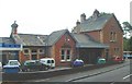
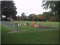
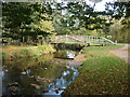
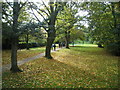
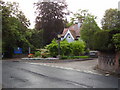
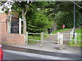
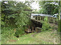
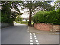
Photos of EX10 8YQ
Area Information
Living in EX10 8YQ offers a quiet, residential experience shaped by its small cluster of homes and low population density. With 1,747 residents spread across 562 people per square kilometre, this area feels intentionally compact, designed for those seeking a peaceful, close-knit environment. The community is predominantly elderly, with a median age of 70, suggesting a demographic focused on stability and long-term living. Daily life here is likely characterised by routine and familiarity, with minimal congestion or noise. The area’s small size means amenities and services are within practical reach, though it is not a hub for commercial or cultural activity. For buyers, this postcode appeals to those prioritising safety, low crime rates, and a mature population. Its lack of planning constraints—no protected woodlands, wetlands, or AONB areas—means development restrictions are minimal. However, its small scale means it is not suited to those seeking a bustling urban lifestyle. The presence of independent schools and basic retail nearby suggests a self-contained, family-friendly atmosphere, though the area’s character is defined more by its tranquility than its vibrancy.
- Area Type
- Postcode
- Area Size
- Not available
- Population
- 1747
- Population Density
- 562 people/km²
The property market in EX10 8YQ is dominated by owner-occupied homes, with 84% of properties owned outright. This high ownership rate indicates a stable market with little reliance on rental activity, suggesting that buyers here are likely purchasing for long-term residence rather than investment. The accommodation type is exclusively houses, which is unusual for a small postcode area but aligns with the low population density and mature demographic. This means the housing stock is likely older, with traditional layouts and potentially limited modern amenities. For buyers, this creates a niche market where properties are not subject to high demand from renters or investors. The small size of the area also means the surrounding region may offer more options, but proximity to EX10 8YQ’s amenities and safety profile could make it an attractive choice for those seeking a quiet, secure home. However, the lack of planning constraints and the focus on single-family homes may limit future development or diversification of the housing stock.
House Prices in EX10 8YQ
No properties found in this postcode.
Energy Efficiency in EX10 8YQ
Residents of EX10 8YQ have access to basic retail amenities within practical reach, including Spar, Tesco Sidmouth, and Co-op Sidmouth. These stores provide essential shopping options for groceries and everyday items, reducing the need for long commutes. The area’s small scale means these amenities are likely within walking or short driving distance, contributing to a convenient, self-contained lifestyle. Beyond retail, the data does not specify additional leisure or recreational facilities, but the presence of nearby schools and the lack of planning constraints suggest that outdoor spaces or parks may exist in the surrounding area. The character of daily life here is likely defined by routine, with limited opportunities for cultural or social activities beyond the immediate vicinity. For those prioritising simplicity and proximity to essentials, the available amenities support a low-maintenance lifestyle. However, the absence of detailed information on dining, leisure, or community hubs means that buyers should consider whether this level of convenience aligns with their needs.
Amenities
Schools
The nearest school to EX10 8YQ is St John’s School, an independent institution. While no Ofsted rating is provided, the presence of an independent school suggests a focus on private education, which may appeal to families prioritising tailored curricula or specific educational philosophies. However, the data does not mention state schools or other educational institutions in the area, which could be a consideration for families seeking a range of options. The absence of additional schools implies that residents may need to travel further for public education, though the independent school may serve as a primary option for those who can afford it. For buyers, this could be a key factor—either a benefit for those preferring private schooling or a limitation for those requiring access to state-run institutions. The single school listed reflects the area’s small size and specialised nature, which may not cater to all family needs but aligns with its overall character of quiet, low-density living.
| Rank | School | Type | Entry gender | Ages |
|---|
Explore more schools in this area
Go to Schools tabDemographics
The community in EX10 8YQ is overwhelmingly elderly, with 70 as the median age and the majority of residents aged 65 or older. This demographic profile suggests a population largely composed of retirees or long-term residents, which influences the area’s social dynamics and housing needs. Home ownership is exceptionally high at 84%, indicating a stable, long-term resident base with little turnover. The accommodation type is predominantly houses, which aligns with the area’s low density and older demographic. The predominant ethnic group is White, reflecting a homogenous community with no significant ethnic diversity noted in the data. While deprivation data is not provided, the high home ownership rate and low crime risk suggest a population with relatively stable economic conditions. However, the elderly demographic may require tailored healthcare and community services, which are not detailed here. The area’s characteristics—low population, mature residents, and high ownership—paint a picture of a place where residents prioritise security, comfort, and familiarity over rapid change or expansion.
Household Size
Accommodation Type
Tenure
Ethnic Group
Religion
Household Composition
Age
Household Deprivation
NS-SEC
Explore more demographic insights in this area
Go to Demographics tabPlanning
Planning Constraints
- Flood RiskPremium
- Ramsar Wetland SitesPremium
- Area of Outstanding Natural BeautyPremium
- Protected Nature ReservePremium
- Protected WoodlandPremium