Area Overview for EX10 8NS
Photos of EX10 8NS
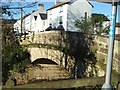

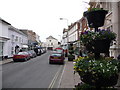
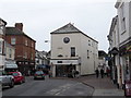
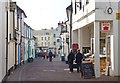
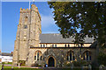
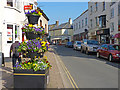
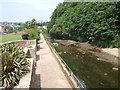
99 photos from this area
Area Information
Key information about the EX10 8NS including its size, population, and administrative classification.
- Area Type
- Postcode
- Area Size
- 1.4 hectares
- Population
- 1738
- Population Density
- 3974 people/km²
House Prices in EX10 8NS
8
Properties
£290,333
Average Sold Price
£71,000
Lowest Price
£450,000
Highest Price
Showing 8 properties
| Address | Type | Beds | Baths | Last Sale Price | Last Sale Date | |
|---|---|---|---|---|---|---|
| 6, Fort Flats, The Esplanade, Sidmouth, EX10 8NS | Flat | 2 | 1 | £350,000 | Jul 2023 | |
| 5, Fort Flats, The Esplanade, Sidmouth, EX10 8NS | Flat | 2 | 2 | £450,000 | Mar 2023 | |
| 1, Fort Flats, The Esplanade, Sidmouth, EX10 8NS | Flat | - | - | £71,000 | Feb 2002 | |
| 3, Fort Flats, The Esplanade, Sidmouth, EX10 8NS | Flat | - | - | - | - | |
| 4, Fort Flats, The Esplanade, Sidmouth, EX10 8NS | Flat | - | - | - | - | |
| 8, Fort Flats, The Esplanade, Sidmouth, EX10 8NS | Flat | - | - | - | - | |
| Toilets The Arches, The Esplanade, Sidmouth, EX10 8NS | commercial | - | - | - | - | |
| 7, Fort Flats, The Esplanade, Sidmouth, EX10 8NS | hotel | - | - | - | - |
Energy Efficiency in EX10 8NS
Amenities
Schools
| Rank | School | Type | Entry gender | Ages |
|---|
Explore more schools in this area
Go to Schools tabDemographics
Household Size
One person
most common
Accommodation Type
Houses
most common
Tenure
67
majority
Ethnic Group
White
most common
Religion
N/A
most common
Household Composition
N/A
most common
Age
47
median
Elderly (65+ years)
most common
Household Deprivation
N/A
with no deprivation
NS-SEC
34
in Lower managerial occupations
Explore more demographic insights in this area
Go to Demographics tabPlanning
Planning Constraints
- Flood RiskPremium
- Ramsar Wetland SitesPremium
- Area of Outstanding Natural BeautyPremium
- Protected Nature ReservePremium
- Protected WoodlandPremium