Area Overview for Dymock
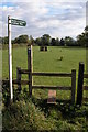
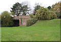
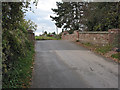
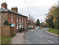
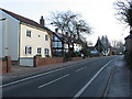
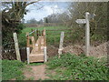
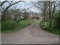
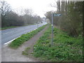
Photos of Dymock


Area Information
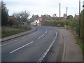
Dymock is a compact built-up area spanning 26 hectares, nestled in England. Its small size fosters a tight-knit community, where daily life is shaped by proximity to local amenities and a relatively low population density. The area’s demographic profile suggests a mature population, with a median age of 70, indicating a community rooted in stability and long-term residency. Home ownership is high, at 77%, reflecting a preference for settled living. Residents benefit from nearby retail outlets, including Spar and Co-op Manchester, and access to Ledbury Railway Station, which connects to broader transport networks. While Dymock lacks large-scale infrastructure, its charm lies in simplicity and practicality. The presence of a single primary school, Ann Cam Church of England Primary School, underscores the area’s focus on family needs. For those seeking a quiet, low-maintenance lifestyle with essential services within walking distance, Dymock offers a straightforward, unpretentious living environment.
- Area Type
- Built Up Area 250
- Area Size
- 26.0 hectares
- Population
- Not available
- Population Density
- Not available
Residents of Dymock have access to a handful of retail outlets, including Spar and Co-op Manchester, which provide essential shopping needs. The presence of multiple Spar stores suggests a practical, no-frills approach to local commerce. For transport, Ledbury Railway Station offers a direct link to broader networks, though the area’s small size means most amenities are within walking distance. The absence of parks or leisure facilities in the data means the area’s recreational options are limited to what is immediately accessible. The lifestyle here is defined by simplicity: a focus on local shops, reliable rail connections, and a community-oriented environment. While not a destination for those seeking luxury or extensive leisure options, Dymock caters to those who value convenience and minimal hassle in daily life.
Amenities
Schools
The nearest school to Dymock is Ann Cam Church of England Primary School, a primary institution with an Ofsted rating of “good.” This single school serves the area’s educational needs, though the absence of secondary schools or alternative providers means families may need to travel for higher education. The presence of a primary school with a positive rating indicates a baseline of quality for early years education. However, the limited range of school types—only a primary school is listed—suggests that parents seeking a broader choice of educational settings may need to look beyond Dymock. For those prioritising proximity to schools, this is a key consideration, though the area’s small size means the school is likely within walking distance for most residents.
| Rank | A + A* % | School | Type | Entry gender | Ages |
|---|---|---|---|---|---|
| 1 | N/A | Ann Cam Church of England Primary School | primary | N/A | N/A |
| 2 | N/A | Ann Cam Church of England Primary School | primary | N/A | N/A |
Explore more schools in this area
Go to Schools tabDemographics
Dymock’s population skews significantly towards older residents, with a median age of 70. This suggests a community where many have lived for decades, contributing to a stable, familiar social fabric. Home ownership dominates, with 77% of households owning their properties, a figure that implies a preference for long-term investment over rental tenancies. The data does not specify household composition or accommodation types, but the high ownership rate indicates a settled population. The absence of detailed diversity metrics means the area’s cultural and ethnic composition remains unspecified. However, the age profile and ownership levels suggest a demographic prioritising security and continuity over transient living. For buyers, this points to a market where properties are likely to be family-owned and well-maintained, with fewer short-term rental pressures.
Household Size
Accommodation Type
Tenure
Ethnic Group
Religion
Household Composition
Age
Household Deprivation
NS-SEC
Explore more demographic insights in this area
Go to Demographics tabPlanning
Planning Constraints
- Crime RiskLocked