Area Overview for Dunsford
Photos of Dunsford

Area Information
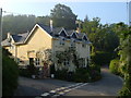
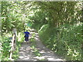
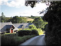
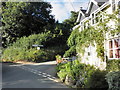
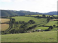
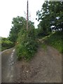
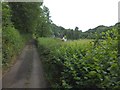
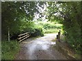
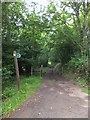
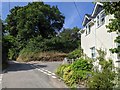
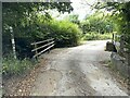
Dunsford is a small civil parish covering an area of 23.7 square kilometres in England. Living here means embracing a rural lifestyle defined by its quiet character and established community. The low population density allows residents to enjoy spacious surroundings while maintaining connection to local services. You will find a neighbourhood that prioritises independence and peaceful days rather than rapid urban development. This area caters to those seeking a slower pace of life, away from the congestion and noise of larger towns. Daily life revolves around local amenities and the natural landscape that surrounds the parish. The setting offers a distinct alternative to city living, where the focus remains on long-term settlement and stability. Prospective buyers looking for homes in Dunsford can expect a traditional environment without the pressures of high-demand urban markets. The location provides a solid foundation for families or individuals wishing to establish a permanent foothold in the county. You will appreciate the sense of place that comes with such a defined and manageable neighbourhood boundary.
- Area Type
- Parish
- Area Size
- 23.7 km²
- Population
- Not available
- Population Density
- Not available
Demographics
The community in Dunsford reflects a settled demographic with a median age of 70 years. Most residents fall into the older age category, indicating that this parish appeals to retirees or those spending their later years in a quiet setting. Home ownership is prevalent, with 79 per cent of households owning their property outright or with a mortgage. This high level of ownership suggests financial stability and a long-term commitment to the area. The majority of accommodation consists of owned dwellings rather than rented apartments or flats. You will encounter a homogenous population where traditional household structures dominate the local scene. The area does not show signs of significant recent migration or diverse household compositions. Residents typically stay in their homes for extended periods, contributing to social continuity. This demographic profile means that local services, such as schools near Dunsford, may not cater to young children in large numbers. Instead, the community focuses on supporting the needs of an older population. The 79 per cent ownership rate also implies a stable tax base and lower turnover of properties compared to transient areas.
Household Size
Accommodation Type
Tenure
Ethnic Group
Religion
Household Composition
Age
Household Deprivation
NS-SEC
Explore more demographic insights in this area
Go to Demographics tabPlanning
Planning Constraints
- Flood RiskPremium
- Ramsar Wetland SitesPremium
- Area of Outstanding Natural BeautyPremium
- Protected Nature ReservePremium
- Protected WoodlandPremium
- Crime RiskPremium