Area Overview for DT9 6PE
Photos of DT9 6PE
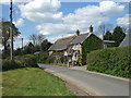
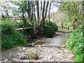

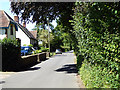
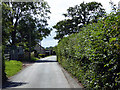
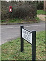
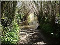
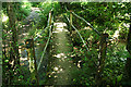
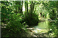
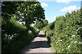
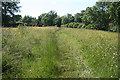
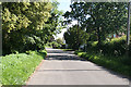
20 photos from this area
Area Information
Key information about the DT9 6PE including its size, population, and administrative classification.
- Area Type
- Postcode
- Area Size
- 62.9 hectares
- Population
- 1871
- Population Density
- 25 people/km²
House Prices in DT9 6PE
38
Properties
£471,527
Average Sold Price
£77,000
Lowest Price
£1,380,000
Highest Price
Showing 38 properties
| Address | Type | Beds | Baths | Last Sale Price | Last Sale Date | |
|---|---|---|---|---|---|---|
| Westhay, Station Road Junction To Higher Farm Junction, Chetnole, DT9 6PE | house | - | - | £380,000 | Jun 2024 | |
| Thurlands, Batcombe Lane, Chetnole, DT9 6PE | house | - | - | £1,380,000 | Oct 2021 | |
| The Old Parsonage, Batcombe Lane, Chetnole, DT9 6PE | house | - | - | £1,325,000 | Jun 2021 | |
| Old Barn Cottage, Higher Farm Junction Chetnole To Hell Corner, Chetnole, DT9 6PE | house | - | - | £600,000 | Sep 2020 | |
| Riverside Barn, Higher Farm Junction Chetnole To Hell Corner, Chetnole, DT9 6PE | Detached | - | - | £305,000 | Jan 2020 | |
| Far Orchard, Higher Farm Junction Chetnole To Hell Corner, Chetnole, DT9 6PE | Bungalow | - | - | £345,000 | Oct 2019 | |
| Kingswood, Batcombe Lane, Chetnole, DT9 6PE | Detached | 3 | - | £520,000 | Dec 2018 | |
| Heneford House, Higher Farm Junction Chetnole To Hell Corner, Chetnole, DT9 6PE | Detached | 4 | - | £850,000 | Jul 2017 | |
| Poachers Lodge, Higher Farm Junction Chetnole To Hell Corner, Chetnole, DT9 6PE | house | - | - | £403,000 | Jun 2017 | |
| Waltham House, Higher Farm Junction Chetnole To Hell Corner, Chetnole, DT9 6PE | Detached | 4 | - | £432,000 | Sep 2015 |
Page 1 of 4
Energy Efficiency in DT9 6PE
Amenities
Schools
| Rank | School | Type | Entry gender | Ages |
|---|
Explore more schools in this area
Go to Schools tabDemographics
Household Size
Two person
most common
Accommodation Type
Houses
most common
Tenure
67
majority
Ethnic Group
White
most common
Religion
N/A
most common
Household Composition
N/A
most common
Age
47
median
Adults (30-64 years)
most common
Household Deprivation
N/A
with no deprivation
NS-SEC
38
in Lower managerial occupations
Explore more demographic insights in this area
Go to Demographics tabPlanning
Planning Constraints
- Flood RiskPremium
- Ramsar Wetland SitesPremium
- Area of Outstanding Natural BeautyPremium
- Protected Nature ReservePremium
- Protected WoodlandPremium