Area Overview for DT9 6DR
Photos of DT9 6DR
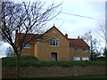
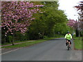
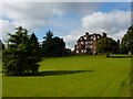
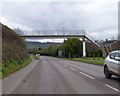


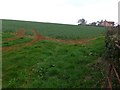
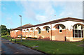
21 photos from this area
Area Information
Key information about the DT9 6DR including its size, population, and administrative classification.
- Area Type
- Postcode
- Area Size
- 2.1 hectares
- Population
- 1592
- Population Density
- 841 people/km²
House Prices in DT9 6DR
15
Properties
£588,333
Average Sold Price
£295,000
Lowest Price
£895,000
Highest Price
Showing 15 properties
| Address | Type | Beds | Baths | Last Sale Price | Last Sale Date | |
|---|---|---|---|---|---|---|
| 24 Gainsborough Drive, Sherborne, DT9 6DR | Detached | 4 | 2 | £570,000 | Oct 2025 | |
| 30 Gainsborough Drive, Sherborne, DT9 6DR | house | - | - | £895,000 | Mar 2025 | |
| 4 Gainsborough Drive, Sherborne, DT9 6DR | Bungalow | 4 | 2 | £825,000 | Jan 2025 | |
| 26 Gainsborough Drive, Sherborne, DT9 6DR | house | 5 | - | £780,000 | Feb 2023 | |
| 14 Gainsborough Drive, Sherborne, DT9 6DR | Detached | 5 | - | £647,000 | Oct 2019 | |
| 28 Gainsborough Drive, Sherborne, DT9 6DR | Detached | 5 | 3 | £625,000 | Jun 2019 | |
| 10 Gainsborough Drive, Sherborne, DT9 6DR | house | 5 | - | £635,000 | Feb 2017 | |
| 2 Gainsborough Drive, Sherborne, DT9 6DR | Bungalow | - | - | £525,000 | Aug 2015 | |
| 6 Gainsborough Drive, Sherborne, DT9 6DR | Detached | 5 | - | £675,000 | Jun 2013 | |
| 16 Gainsborough Drive, Sherborne, DT9 6DR | Detached | 4 | - | £525,000 | Jun 2013 |
Page 1 of 2
Energy Efficiency in DT9 6DR
Amenities
Schools
| Rank | School | Type | Entry gender | Ages |
|---|
Explore more schools in this area
Go to Schools tabDemographics
Household Size
Two person
most common
Accommodation Type
Houses
most common
Tenure
73
majority
Ethnic Group
White
most common
Religion
N/A
most common
Household Composition
N/A
most common
Age
47
median
Elderly (65+ years)
most common
Household Deprivation
N/A
with no deprivation
NS-SEC
42
in Lower managerial occupations
Explore more demographic insights in this area
Go to Demographics tabPlanning
Planning Constraints
- Flood RiskPremium
- Ramsar Wetland SitesPremium
- Area of Outstanding Natural BeautyPremium
- Protected Nature ReservePremium
- Protected WoodlandPremium