Area Overview for DT9 4HH
Photos of DT9 4HH

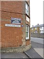
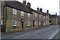
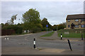
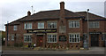
42 photos from this area
Area Information
Key information about the DT9 4HH including its size, population, and administrative classification.
- Area Type
- Postcode
- Area Size
- 6781 m²
- Population
- 1606
- Population Density
- 2910 people/km²
House Prices in DT9 4HH
14
Properties
£487,857
Average Sold Price
£335,000
Lowest Price
£650,000
Highest Price
Showing 14 properties
| Address | Type | Beds | Baths | Last Sale Price | Last Sale Date | |
|---|---|---|---|---|---|---|
| 9 Fairfield Heights, Sherborne, DT9 4HH | Detached | 4 | 2 | £625,000 | Oct 2023 | |
| 12 Fairfield Heights, Sherborne, DT9 4HH | house | - | - | £650,000 | Aug 2023 | |
| 7 Fairfield Heights, Sherborne, DT9 4HH | Semi-detached | 4 | 2 | £495,000 | Feb 2021 | |
| Ballantoy, 13 Fairfield Heights, Sherborne, DT9 4HH | Semi-detached | 4 | - | £525,000 | Nov 2020 | |
| 10 Fairfield Heights, Sherborne, DT9 4HH | house | - | - | £385,000 | Oct 2005 | |
| 11 Fairfield Heights, Sherborne, DT9 4HH | house | - | - | £400,000 | Sep 2005 | |
| 14 Fairfield Heights, Sherborne, DT9 4HH | Semi-detached | - | - | £335,000 | May 2005 | |
| 1 Fairfield Heights, Sherborne, DT9 4HH | Detached | 4 | 2 | - | - | |
| 8 Fairfield Heights, Sherborne, DT9 4HH | house | 4 | - | - | - | |
| 2 Fairfield Heights, Sherborne, DT9 4HH | house | 5 | - | - | - |
Page 1 of 2
Energy Efficiency in DT9 4HH
Amenities
Schools
| Rank | School | Type | Entry gender | Ages |
|---|
Explore more schools in this area
Go to Schools tabDemographics
Household Size
One person
most common
Accommodation Type
Houses
most common
Tenure
68
majority
Ethnic Group
White
most common
Religion
N/A
most common
Household Composition
N/A
most common
Age
47
median
Elderly (65+ years)
most common
Household Deprivation
N/A
with no deprivation
NS-SEC
46
in Lower managerial occupations
Explore more demographic insights in this area
Go to Demographics tabPlanning
Planning Constraints
- Flood RiskPremium
- Ramsar Wetland SitesPremium
- Area of Outstanding Natural BeautyPremium
- Protected Nature ReservePremium
- Protected WoodlandPremium