Area Overview for DT9 4EQ
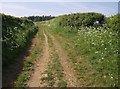
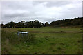
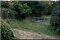
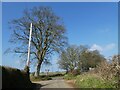
Photos of DT9 4EQ


Area Information
Living in DT9 4EQ offers a compact, residential experience shaped by its small footprint and high population density. The area covers just 9.8 hectares, housing 1,454 residents in a tightly knit cluster. This makes it a quiet, community-focused environment where daily life is defined by proximity to essential services and local amenities. The area’s demographics suggest a mature population, with a median age of 47 and most residents falling within the 30-64 age range. This mix of adults likely contributes to a stable, established neighbourhood with a focus on practical living. Nearby, the area benefits from multiple retail outlets, including Spar Simons, Waitrose Sherborne, and Morrisons Daily, ensuring everyday needs are met. For transport, residents have access to rail services at Sherborne, Yeovil Pen Mill, and Thornford stations, connecting them to broader regional networks. The area’s low flood risk and below-average crime rates further enhance its appeal as a safe, low-stress living environment.
- Area Type
- Postcode
- Area Size
- 9.8 hectares
- Population
- 1454
- Population Density
- 2085 people/km²
The property market in DT9 4EQ is characterised by a 55% home ownership rate, with houses being the primary accommodation type. This suggests a focus on owner-occupied properties rather than a rental-dominated market, though the exact proportion of rental homes is not specified. Given the area’s small size—just 9.8 hectares—property availability is likely limited, making it a niche market for buyers seeking a compact, residential setting. The dominance of houses may appeal to those prioritising space and privacy, though the high population density implies proximity to neighbours. For buyers, this area’s immediate surroundings may offer few alternatives, necessitating a careful evaluation of property options. The lack of detailed data on property prices or recent market trends means potential buyers should conduct local investigations to gauge current conditions.
House Prices in DT9 4EQ
No properties found in this postcode.
Energy Efficiency in DT9 4EQ
Daily life in DT9 4EQ is shaped by its proximity to retail and transport hubs. The area’s retail offerings include Spar Simons, Waitrose Sherborne, and Morrisons Daily, providing a range of shopping options for groceries and essentials. These stores support a convenience-focused lifestyle, reducing the need for long trips to larger centres. The presence of multiple rail stations, such as Sherborne and Yeovil Pen Mill, enhances mobility, connecting residents to broader networks for work, leisure, or socialising. While the data does not specify parks or recreational facilities, the area’s compact nature may encourage walking or cycling for local errands. The combination of retail access and rail connectivity suggests a practical, community-oriented lifestyle, though further details on leisure options would require local investigation.
Amenities
Schools
Residents of DT9 4EQ have access to a range of primary schools, including Sherborne Primary School, The Gryphon School, and St Aldhelm’s School, which cater to younger children. The Gryphon School also operates as an academy with an Ofsted rating of ‘good’, indicating a reliable standard of education. Sherborne Learning Centre provides additional educational support, though its specific focus is not detailed. The presence of multiple primary schools suggests a family-friendly environment, with options for different educational preferences. The mix of school types—traditional primary schools and academies—may allow parents to choose between established institutions and those with potentially more specialised curricula. This variety supports families seeking flexibility in their children’s schooling, though secondary education options are not listed in the data.
| Rank | School | Type | Entry gender | Ages |
|---|
Explore more schools in this area
Go to Schools tabDemographics
The community in DT9 4EQ is predominantly composed of adults aged 30-64, with a median age of 47. This suggests a mature, settled population, likely with established careers and families. Home ownership stands at 55%, indicating a mix of owner-occupied properties and rentals, though the exact balance of rental versus owner-occupied homes is not specified. The area’s accommodation is primarily houses, which may reflect a preference for single-family living. The predominant ethnic group is White, though specific diversity metrics are not provided. With a population density of 14,841 people per square kilometre, the area is highly compact, which may influence social dynamics and the sense of community. The absence of detailed data on deprivation or income levels means quality of life factors beyond population statistics remain unexplored here.
Household Size
Accommodation Type
Tenure
Ethnic Group
Religion
Household Composition
Age
Household Deprivation
NS-SEC
Explore more demographic insights in this area
Go to Demographics tabPlanning
Planning Constraints
- Flood RiskPremium
- Ramsar Wetland SitesPremium
- Area of Outstanding Natural BeautyPremium
- Protected Nature ReservePremium
- Protected WoodlandPremium