Area Overview for DT9 4BJ
Photos of DT9 4BJ

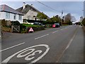
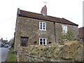
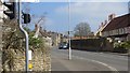
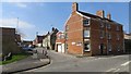
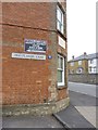
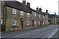
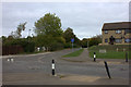
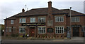
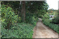
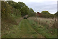
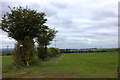
42 photos from this area
Area Information
Key information about the DT9 4BJ including its size, population, and administrative classification.
- Area Type
- Postcode
- Area Size
- 2.3 hectares
- Population
- 1766
- Population Density
- 1013 people/km²
House Prices in DT9 4BJ
16
Properties
£561,889
Average Sold Price
£215,000
Lowest Price
£967,500
Highest Price
Showing 16 properties
| Address | Type | Beds | Baths | Last Sale Price | Last Sale Date | |
|---|---|---|---|---|---|---|
| Greenholme, Marston Road, Sherborne, DT9 4BJ | Detached | 5 | 3 | £625,000 | Mar 2025 | |
| Pentley House, Marston Road, Sherborne, DT9 4BJ | house | - | - | £920,000 | Feb 2025 | |
| The Old Pound, Marston Road, Sherborne, DT9 4BJ | house | 5 | 3 | £967,500 | Aug 2024 | |
| Coombe House, Marston Road, Sherborne, DT9 4BJ | Bungalow | 5 | 3 | £475,500 | Apr 2024 | |
| Fairmead, Marston Road, Sherborne, DT9 4BJ | house | - | - | £687,500 | Dec 2021 | |
| Cleve House, Marston Road, Sherborne, DT9 4BJ | house | - | - | £385,000 | Oct 2018 | |
| Kenilworth, Marston Road, Sherborne, DT9 4BJ | Semi-detached | 3 | - | £265,000 | Apr 2014 | |
| Mapwl House, Marston Road, Sherborne, DT9 4BJ | Detached | 4 | 3 | £516,500 | May 2011 | |
| Clanfield Cottage, Marston Road, Sherborne, DT9 4BJ | Detached | - | - | £215,000 | Jun 2006 | |
| Beacon Way, Marston Road, Sherborne, DT9 4BJ | Bungalow | 2 | 1 | - | - |
Page 1 of 2
Energy Efficiency in DT9 4BJ
Amenities
Schools
| Rank | School | Type | Entry gender | Ages |
|---|
Explore more schools in this area
Go to Schools tabDemographics
Household Size
Two person
most common
Accommodation Type
Houses
most common
Tenure
70
majority
Ethnic Group
White
most common
Religion
N/A
most common
Household Composition
N/A
most common
Age
47
median
Adults (30-64 years)
most common
Household Deprivation
N/A
with no deprivation
NS-SEC
39
in Lower managerial occupations
Explore more demographic insights in this area
Go to Demographics tabPlanning
Planning Constraints
- Flood RiskPremium
- Ramsar Wetland SitesPremium
- Area of Outstanding Natural BeautyPremium
- Protected Nature ReservePremium
- Protected WoodlandPremium