Area Overview for DT9 3JS
Photos of DT9 3JS
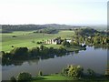
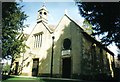


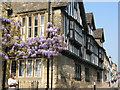
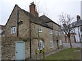
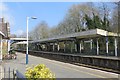
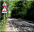
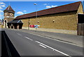
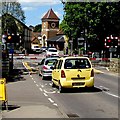
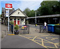
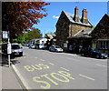
100 photos from this area
Area Information
Key information about the DT9 3JS including its size, population, and administrative classification.
- Area Type
- Postcode
- Area Size
- 2007 m²
- Population
- 1606
- Population Density
- 2910 people/km²
House Prices in DT9 3JS
15
Properties
£171,955
Average Sold Price
£56,000
Lowest Price
£269,500
Highest Price
Showing 15 properties
| Address | Type | Beds | Baths | Last Sale Price | Last Sale Date | |
|---|---|---|---|---|---|---|
| 11 Fairmont Terrace, Sherborne, DT9 3JS | Terraced | 2 | 1 | £269,500 | Oct 2025 | |
| 1 Fairmont Terrace, Sherborne, DT9 3JS | Terraced | 2 | 1 | £262,000 | Dec 2023 | |
| 6 Fairmont Terrace, Sherborne, DT9 3JS | Terraced | 2 | - | £228,000 | Mar 2020 | |
| 2 Fairmont Terrace, Sherborne, DT9 3JS | Terraced | 2 | - | £202,000 | Mar 2017 | |
| 9 Fairmont Terrace, Sherborne, DT9 3JS | Terraced | 2 | 1 | £195,000 | Mar 2016 | |
| 8 Fairmont Terrace, Sherborne, DT9 3JS | Terraced | 2 | 1 | £197,000 | Feb 2016 | |
| 4 Fairmont Terrace, Sherborne, DT9 3JS | house | 2 | - | £137,500 | Aug 2013 | |
| 10 Fairmont Terrace, Sherborne, DT9 3JS | Terraced | - | - | £133,000 | May 2006 | |
| 13 Fairmont Terrace, Sherborne, DT9 3JS | Terraced | - | - | £153,500 | Dec 2005 | |
| 3 Fairmont Terrace, Sherborne, DT9 3JS | Terraced | - | - | £58,000 | Jul 1999 |
Page 1 of 2
Energy Efficiency in DT9 3JS
Amenities
Schools
| Rank | School | Type | Entry gender | Ages |
|---|
Explore more schools in this area
Go to Schools tabDemographics
Household Size
One person
most common
Accommodation Type
Houses
most common
Tenure
68
majority
Ethnic Group
White
most common
Religion
N/A
most common
Household Composition
N/A
most common
Age
47
median
Elderly (65+ years)
most common
Household Deprivation
N/A
with no deprivation
NS-SEC
46
in Lower managerial occupations
Explore more demographic insights in this area
Go to Demographics tabPlanning
Planning Constraints
- Flood RiskPremium
- Ramsar Wetland SitesPremium
- Area of Outstanding Natural BeautyPremium
- Protected Nature ReservePremium
- Protected WoodlandPremium