Area Overview for DT9 3JE
Photos of DT9 3JE
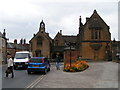
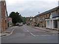
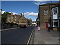
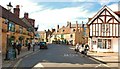
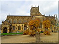
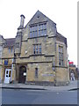
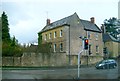
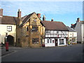
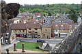
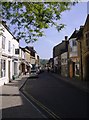
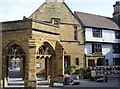
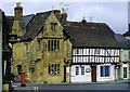
100 photos from this area
Area Information
Key information about the DT9 3JE including its size, population, and administrative classification.
- Area Type
- Postcode
- Area Size
- 9680 m²
- Population
- 1766
- Population Density
- 1013 people/km²
House Prices in DT9 3JE
11
Properties
£271,400
Average Sold Price
£170,000
Lowest Price
£360,000
Highest Price
Showing 11 properties
| Address | Type | Beds | Baths | Last Sale Price | Last Sale Date | |
|---|---|---|---|---|---|---|
| Lawnden, Back Lane, Sherborne, DT9 3JE | house | - | - | £360,000 | Mar 2025 | |
| Midway Cottage, Back Lane, Sherborne, DT9 3JE | house | - | - | £330,000 | Nov 2019 | |
| 86 Back Lane, Sherborne, DT9 3JE | Cottage | 2 | - | £182,000 | Jul 2016 | |
| 87 Back Lane, Sherborne, DT9 3JE | Terraced | 1 | 2 | £170,000 | Apr 2015 | |
| Keld Cottage, Back Lane, Sherborne, DT9 3JE | Cottage | 3 | 1 | £315,000 | Oct 2006 | |
| Homestead, Back Lane, Sherborne, DT9 3JE | house | 2 | - | - | - | |
| Ashleys Bungalow, Back Lane, Sherborne, DT9 3JE | Detached | - | - | - | - | |
| The Flat, Yeatman Hospital, Back Lane, Sherborne, DT9 3JE | Flat | - | - | - | - | |
| 1 Back Lane, Sherborne, DT9 3JE | house | 1 | - | - | - | |
| The Cottage, Back Lane, Sherborne, DT9 3JE | house | - | - | - | - |
Page 1 of 2
Energy Efficiency in DT9 3JE
Amenities
Schools
| Rank | School | Type | Entry gender | Ages |
|---|
Explore more schools in this area
Go to Schools tabDemographics
Household Size
Two person
most common
Accommodation Type
Houses
most common
Tenure
70
majority
Ethnic Group
White
most common
Religion
N/A
most common
Household Composition
N/A
most common
Age
47
median
Adults (30-64 years)
most common
Household Deprivation
N/A
with no deprivation
NS-SEC
39
in Lower managerial occupations
Explore more demographic insights in this area
Go to Demographics tabPlanning
Planning Constraints
- Flood RiskPremium
- Ramsar Wetland SitesPremium
- Area of Outstanding Natural BeautyPremium
- Protected Nature ReservePremium
- Protected WoodlandPremium