Area Overview for DT9 3DD
Photos of DT9 3DD
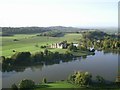
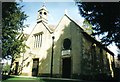


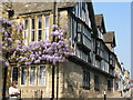
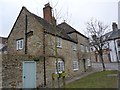
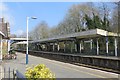
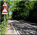
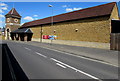
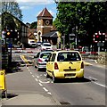
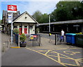
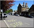
100 photos from this area
Area Information
Key information about the DT9 3DD including its size, population, and administrative classification.
- Area Type
- Postcode
- Area Size
- 9810 m²
- Population
- 1606
- Population Density
- 2910 people/km²
House Prices in DT9 3DD
20
Properties
£433,188
Average Sold Price
£60,000
Lowest Price
£950,000
Highest Price
Showing 20 properties
| Address | Type | Beds | Baths | Last Sale Price | Last Sale Date | |
|---|---|---|---|---|---|---|
| Masongill, Long Street, Sherborne, DT9 3DD | Terraced | 5 | 2 | £760,000 | Jul 2024 | |
| Stable Lodge, Long Street, Sherborne, DT9 3DD | house | - | - | £850,000 | May 2023 | |
| Rose Villa, Long Street, Sherborne, DT9 3DD | house | 3 | - | £675,000 | Oct 2022 | |
| St Kilda, Long Street, Sherborne, DT9 3DD | Terraced | 4 | 2 | £615,000 | Oct 2022 | |
| Castleton, Long Street, Sherborne, DT9 3DD | Flat | 1 | 1 | £105,000 | Apr 2021 | |
| Ballantyne, Long Street, Sherborne, DT9 3DD | Flat | 2 | 2 | £160,000 | Dec 2020 | |
| The Cedars, Long Street, Sherborne, DT9 3DD | Detached | 5 | 2 | £950,000 | Mar 2020 | |
| The Witch House, Long Street, Sherborne, DT9 3DD | house | - | - | £528,000 | Aug 2017 | |
| Garden Close, Long Street, Sherborne, DT9 3DD | house | - | - | £675,000 | Feb 2014 | |
| The Yews, Long Street, Sherborne, DT9 3DD | house | 5 | - | £400,000 | Nov 2013 |
Page 1 of 2
Energy Efficiency in DT9 3DD
Amenities
Schools
| Rank | School | Type | Entry gender | Ages |
|---|
Explore more schools in this area
Go to Schools tabDemographics
Household Size
One person
most common
Accommodation Type
Houses
most common
Tenure
68
majority
Ethnic Group
White
most common
Religion
N/A
most common
Household Composition
N/A
most common
Age
47
median
Elderly (65+ years)
most common
Household Deprivation
N/A
with no deprivation
NS-SEC
46
in Lower managerial occupations
Explore more demographic insights in this area
Go to Demographics tabPlanning
Planning Constraints
- Flood RiskPremium
- Ramsar Wetland SitesPremium
- Area of Outstanding Natural BeautyPremium
- Protected Nature ReservePremium
- Protected WoodlandPremium