Area Overview for DT8 3EF
Photos of DT8 3EF
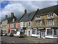
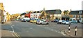
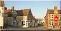
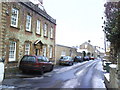
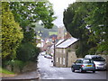
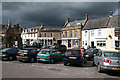
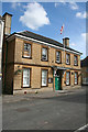
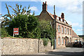
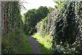
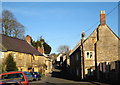
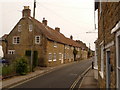
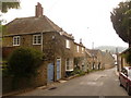
100 photos from this area
Area Information
Key information about the DT8 3EF including its size, population, and administrative classification.
- Area Type
- Postcode
- Area Size
- 1.5 hectares
- Population
- 1394
- Population Density
- 340 people/km²
House Prices in DT8 3EF
41
Properties
£376,800
Average Sold Price
£55,000
Lowest Price
£1,150,000
Highest Price
Showing 41 properties
| Address | Type | Beds | Baths | Last Sale Price | Last Sale Date | |
|---|---|---|---|---|---|---|
| 30 Fleet Street, Beaminster, DT8 3EF | Terraced | 2 | 1 | £317,000 | Sep 2023 | |
| 1 Pines Mews, Beaminster, DT8 3EF | Detached | 4 | 2 | £665,000 | Dec 2022 | |
| 4 Fleet Street, Beaminster, DT8 3EF | Terraced | 4 | - | £395,000 | Nov 2022 | |
| 3 Pines Mews, Beaminster, DT8 3EF | Semi-detached | 3 | 1 | £389,755 | Mar 2022 | |
| 27 Fleet Street, Beaminster, DT8 3EF | Terraced | 2 | 1 | £269,950 | Jan 2022 | |
| 41 Fleet Street, Beaminster, DT8 3EF | Cottage | 2 | 1 | £235,000 | Oct 2021 | |
| 20 Fleet Street, Beaminster, DT8 3EF | Terraced | 3 | 1 | £235,000 | Aug 2021 | |
| 36 Fleet Street, Beaminster, DT8 3EF | Terraced | 2 | 1 | £195,000 | Jun 2021 | |
| 39 Fleet Street, Beaminster, DT8 3EF | Terraced | 2 | 1 | £232,000 | Jun 2021 | |
| 35 Fleet Street, Beaminster, DT8 3EF | house | - | - | £360,000 | Mar 2021 |
Page 1 of 5
Energy Efficiency in DT8 3EF
Amenities
Schools
| Rank | School | Type | Entry gender | Ages |
|---|
Explore more schools in this area
Go to Schools tabDemographics
Household Size
Two person
most common
Accommodation Type
Houses
most common
Tenure
73
majority
Ethnic Group
White
most common
Religion
N/A
most common
Household Composition
N/A
most common
Age
47
median
Elderly (65+ years)
most common
Household Deprivation
N/A
with no deprivation
NS-SEC
34
in Lower managerial occupations
Explore more demographic insights in this area
Go to Demographics tabPlanning
Planning Constraints
- Flood RiskPremium
- Ramsar Wetland SitesPremium
- Area of Outstanding Natural BeautyPremium
- Protected Nature ReservePremium
- Protected WoodlandPremium