Area Overview for DT8 3BE
Photos of DT8 3BE
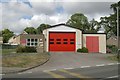
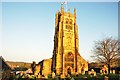
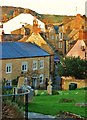
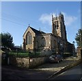
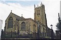
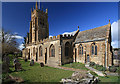
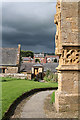
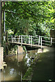
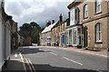
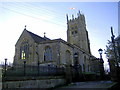
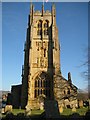
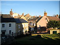
100 photos from this area
Area Information
Key information about the DT8 3BE including its size, population, and administrative classification.
- Area Type
- Postcode
- Area Size
- 4325 m²
- Population
- 1394
- Population Density
- 340 people/km²
House Prices in DT8 3BE
16
Properties
£430,355
Average Sold Price
£115,000
Lowest Price
£1,200,000
Highest Price
Showing 16 properties
| Address | Type | Beds | Baths | Last Sale Price | Last Sale Date | |
|---|---|---|---|---|---|---|
| 4 Shadrack Street, Beaminster, DT8 3BE | Semi-detached | 4 | 3 | £1,200,000 | Mar 2024 | |
| 15 Shadrack Street, Beaminster, DT8 3BE | Cottage | 1 | 1 | £260,000 | Jun 2023 | |
| 8 Shadrack Street, Beaminster, DT8 3BE | Detached | 2 | 1 | £582,000 | Aug 2022 | |
| 5 Shadrack Street, Beaminster, DT8 3BE | house | 4 | - | £680,000 | Dec 2020 | |
| 11 SHADRACK STREET, Beaminster, DT8 3BE | Terraced | 3 | 1 | £345,000 | Dec 2020 | |
| 9 Shadrack Street, Beaminster, DT8 3BE | Terraced | 4 | - | £435,000 | Sep 2019 | |
| 17 Shadrack Street, Beaminster, DT8 3BE | Terraced | 2 | 1 | £260,500 | Apr 2013 | |
| 2 Shadrack Street, Beaminster, DT8 3BE | Terraced | 3 | 2 | £115,000 | Jul 2009 | |
| 3 Shadrack Street, Beaminster, DT8 3BE | house | - | - | £200,000 | Jul 2006 | |
| 6 Shadrack Street, Beaminster, DT8 3BE | Semi-detached | - | - | £226,050 | Apr 2000 |
Page 1 of 2
Energy Efficiency in DT8 3BE
Amenities
Schools
| Rank | School | Type | Entry gender | Ages |
|---|
Explore more schools in this area
Go to Schools tabDemographics
Household Size
Two person
most common
Accommodation Type
Houses
most common
Tenure
73
majority
Ethnic Group
White
most common
Religion
N/A
most common
Household Composition
N/A
most common
Age
47
median
Elderly (65+ years)
most common
Household Deprivation
N/A
with no deprivation
NS-SEC
34
in Lower managerial occupations
Explore more demographic insights in this area
Go to Demographics tabPlanning
Planning Constraints
- Flood RiskPremium
- Ramsar Wetland SitesPremium
- Area of Outstanding Natural BeautyPremium
- Protected Nature ReservePremium
- Protected WoodlandPremium