Area Overview for DT7 3TH
Photos of DT7 3TH
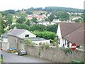
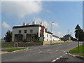
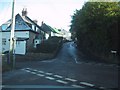
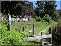
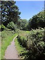
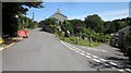
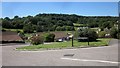
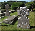
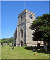

91 photos from this area
Area Information
Key information about the DT7 3TH including its size, population, and administrative classification.
- Area Type
- Postcode
- Area Size
- 3.0 hectares
- Population
- 2549
- Population Density
- 70 people/km²
House Prices in DT7 3TH
21
Properties
£403,682
Average Sold Price
£115,000
Lowest Price
£675,000
Highest Price
Showing 21 properties
| Address | Type | Beds | Baths | Last Sale Price | Last Sale Date | |
|---|---|---|---|---|---|---|
| Leverton, Lyme Road, Uplyme, DT7 3TH | Detached | 3 | 2 | £675,000 | Mar 2023 | |
| Pound Cottage, Lyme Road, Uplyme, DT7 3TH | Detached | 3 | 1 | £345,500 | Jul 2022 | |
| The Old Stores, Lyme Road, Uplyme, DT7 3TH | Flat | 5 | 3 | £675,000 | May 2022 | |
| Pyms Orchard, Lyme Road, Uplyme, DT7 3TH | Cottage | 2 | 2 | £435,000 | Dec 2020 | |
| The Seasons, Lyme Road, Uplyme, DT7 3TH | house | 3 | - | £415,000 | Jan 2019 | |
| Elton, Lyme Road, Uplyme, DT7 3TH | Bungalow | 4 | 3 | £500,000 | Nov 2018 | |
| Rookery View, Lyme Road, Uplyme, DT7 3TH | house | - | - | £320,000 | Oct 2018 | |
| West End, Lyme Road, Uplyme, DT7 3TH | Detached | 4 | - | £450,000 | Jan 2014 | |
| Dalverton Rise, Lyme Road, Uplyme, DT7 3TH | Detached | - | - | £310,000 | Feb 2007 | |
| Dorset View, Lyme Road, Uplyme, DT7 3TH | Bungalow | 2 | - | £115,000 | Oct 1997 |
Page 1 of 3
Energy Efficiency in DT7 3TH
Amenities
Schools
| Rank | School | Type | Entry gender | Ages |
|---|
Explore more schools in this area
Go to Schools tabDemographics
Household Size
Two person
most common
Accommodation Type
Houses
most common
Tenure
82
majority
Ethnic Group
White
most common
Religion
N/A
most common
Household Composition
N/A
most common
Age
47
median
Adults (30-64 years)
most common
Household Deprivation
N/A
with no deprivation
NS-SEC
42
in Lower managerial occupations
Explore more demographic insights in this area
Go to Demographics tabPlanning
Planning Constraints
- Flood RiskPremium
- Ramsar Wetland SitesPremium
- Area of Outstanding Natural BeautyPremium
- Protected Nature ReservePremium
- Protected WoodlandPremium