Area Overview for DT7 3SL
Photos of DT7 3SL
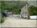
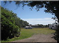
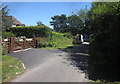


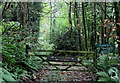
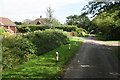
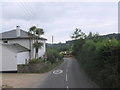
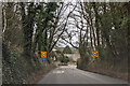
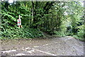
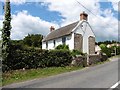
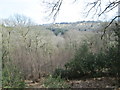
13 photos from this area
Area Information
Key information about the DT7 3SL including its size, population, and administrative classification.
- Area Type
- Postcode
- Area Size
- 56.7 hectares
- Population
- 2549
- Population Density
- 70 people/km²
House Prices in DT7 3SL
27
Properties
£560,200
Average Sold Price
£87,000
Lowest Price
£951,000
Highest Price
Showing 27 properties
| Address | Type | Beds | Baths | Last Sale Price | Last Sale Date | |
|---|---|---|---|---|---|---|
| Greenfields, Woodhouse Hill, Uplyme, DT7 3SL | house | 4 | 2 | £950,000 | Sep 2025 | |
| Larks Hey, Woodhouse Hill, Uplyme, DT7 3SL | Bungalow | 3 | 3 | £945,000 | Apr 2025 | |
| Chelmer, Woodhouse Hill, Uplyme, DT7 3SL | Bungalow | 3 | 2 | £575,000 | Mar 2025 | |
| Kenwood, Woodhouse Hill, Uplyme, DT7 3SL | Detached | 4 | 1 | £780,000 | Jul 2023 | |
| Pacehayne, Woodhouse Hill, Uplyme, DT7 3SL | Bungalow | 4 | 2 | £951,000 | Apr 2022 | |
| Arrington Cottage, Woodhouse Hill, Uplyme, DT7 3SL | Detached | 4 | 4 | £760,000 | Aug 2021 | |
| Pipers Meadow, Woodhouse Hill, Uplyme, DT7 3SL | Bungalow | 3 | 1 | £350,000 | Feb 2021 | |
| Hawkhill, Woodhouse Hill, Uplyme, DT7 3SL | house | 4 | - | £565,000 | Feb 2021 | |
| HIGHOVER, WOODHOUSE HILL, Uplyme, DT7 3SL | Detached | 3 | 1 | £485,000 | Dec 2020 | |
| Hillcrest, Woodhouse Hill, Uplyme, DT7 3SL | Bungalow | 3 | - | £475,000 | Aug 2020 |
Page 1 of 3
Energy Efficiency in DT7 3SL
Amenities
Schools
| Rank | School | Type | Entry gender | Ages |
|---|
Explore more schools in this area
Go to Schools tabDemographics
Household Size
Two person
most common
Accommodation Type
Houses
most common
Tenure
82
majority
Ethnic Group
White
most common
Religion
N/A
most common
Household Composition
N/A
most common
Age
47
median
Adults (30-64 years)
most common
Household Deprivation
N/A
with no deprivation
NS-SEC
42
in Lower managerial occupations
Explore more demographic insights in this area
Go to Demographics tabPlanning
Planning Constraints
- Flood RiskPremium
- Ramsar Wetland SitesPremium
- Area of Outstanding Natural BeautyPremium
- Protected Nature ReservePremium
- Protected WoodlandPremium