Area Overview for DT6 6JU
Photos of DT6 6JU
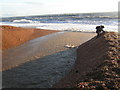
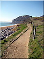
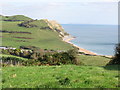
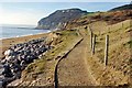
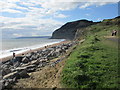
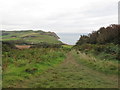
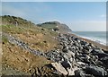

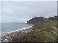
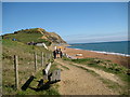
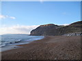
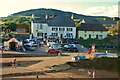
71 photos from this area
Area Information
Key information about the DT6 6JU including its size, population, and administrative classification.
- Area Type
- Postcode
- Area Size
- 21.2 hectares
- Population
- 1785
- Population Density
- 66 people/km²
House Prices in DT6 6JU
9
Properties
£707,000
Average Sold Price
£426,000
Lowest Price
£1,000,000
Highest Price
Showing 9 properties
| Address | Type | Beds | Baths | Last Sale Price | Last Sale Date | |
|---|---|---|---|---|---|---|
| The Guard House Studio, Sea Hill Lane, Seatown, DT6 6JU | Detached | - | - | £695,000 | Mar 2021 | |
| Seatown House, Sea Hill Lane, Seatown, DT6 6JU | Semi-detached | 3 | - | £1,000,000 | Aug 2006 | |
| 2, The Watch House, Sea Hill Lane, Seatown, DT6 6JU | Terraced | - | - | £426,000 | Dec 2004 | |
| Seaside Sauna Haus, Site For Kiosk, Sea Hill Lane, Seatown, DT6 6JU | Retail | - | - | - | - | |
| Anchor Cottage, Sea Hill Lane, Seatown, DT6 6JU | house | - | - | - | - | |
| Anchor Inn, Sea Hill Lane, Seatown, DT6 6JU | restaurant_cafe | - | - | - | - | |
| 1, The Watch House, Sea Hill Lane, Seatown, DT6 6JU | house | - | - | - | - | |
| 3, The Watch House, Sea Hill Lane, Seatown, DT6 6JU | Terraced | - | - | - | - | |
| Residential Accommodation, Anchor Inn, Sea Hill Lane, Seatown, DT6 6JU | Flat | - | - | - | - |
Energy Efficiency in DT6 6JU
Amenities
Schools
| Rank | School | Type | Entry gender | Ages |
|---|
Explore more schools in this area
Go to Schools tabDemographics
Household Size
Two person
most common
Accommodation Type
Houses
most common
Tenure
78
majority
Ethnic Group
White
most common
Religion
N/A
most common
Household Composition
N/A
most common
Age
47
median
Adults (30-64 years)
most common
Household Deprivation
N/A
with no deprivation
NS-SEC
36
in Lower managerial occupations
Explore more demographic insights in this area
Go to Demographics tabPlanning
Planning Constraints
- Flood RiskPremium
- Ramsar Wetland SitesPremium
- Area of Outstanding Natural BeautyPremium
- Protected Nature ReservePremium
- Protected WoodlandPremium