Area Overview for DT6 6AL
Photos of DT6 6AL

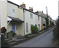

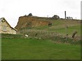
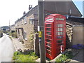
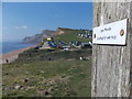

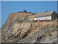
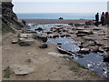
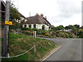
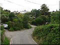
100 photos from this area
Area Information
Key information about the DT6 6AL including its size, population, and administrative classification.
- Area Type
- Postcode
- Area Size
- 51.6 hectares
- Population
- 1785
- Population Density
- 66 people/km²
House Prices in DT6 6AL
36
Properties
£555,817
Average Sold Price
£89,500
Lowest Price
£1,400,400
Highest Price
Showing 36 properties
| Address | Type | Beds | Baths | Last Sale Price | Last Sale Date | |
|---|---|---|---|---|---|---|
| Eype House, Mount Lane, Eype, DT6 6AL | Detached | 5 | 3 | £1,400,400 | May 2022 | |
| Port Cottage, Mount Lane, Eype, DT6 6AL | house | - | - | £400,000 | Mar 2020 | |
| Whin Bridge, Mount Lane, Eype, DT6 6AL | Bungalow | 4 | 3 | £525,000 | Oct 2017 | |
| Pilgrims Latch, Mount Lane, Eype, DT6 6AL | house | - | - | £590,000 | Jan 2014 | |
| Elswood Barn, Mount Lane, Eype, DT6 6AL | house | - | - | £330,000 | May 2002 | |
| Jessamine Cottage, Mount Lane, Eype, DT6 6AL | Semi-detached | - | - | £89,500 | Apr 1998 | |
| The Greenhouse, 15 Eypes Mouth Chalet Park, Eype, DT6 6AL | Bungalow | 2 | 1 | - | - | |
| 11 Eypes Mouth Chalet Park, Eype, DT6 6AL | Bungalow | 2 | - | - | - | |
| Barn Cottage, Mount Lane, Eype, DT6 6AL | Detached | 3 | 3 | - | - | |
| The Chalet, Eypes Mouth Car Park, Mount Lane, Eype, DT6 6AL | Bungalow | 1 | - | - | - |
Page 1 of 4
Energy Efficiency in DT6 6AL
Amenities
Schools
| Rank | School | Type | Entry gender | Ages |
|---|
Explore more schools in this area
Go to Schools tabDemographics
Household Size
Two person
most common
Accommodation Type
Houses
most common
Tenure
78
majority
Ethnic Group
White
most common
Religion
N/A
most common
Household Composition
N/A
most common
Age
47
median
Adults (30-64 years)
most common
Household Deprivation
N/A
with no deprivation
NS-SEC
36
in Lower managerial occupations
Explore more demographic insights in this area
Go to Demographics tabPlanning
Planning Constraints
- Flood RiskPremium
- Ramsar Wetland SitesPremium
- Area of Outstanding Natural BeautyPremium
- Protected Nature ReservePremium
- Protected WoodlandPremium