Area Overview for DT6 5PS
Photos of DT6 5PS
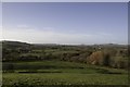
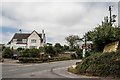
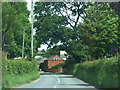
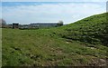
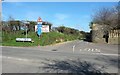
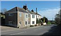
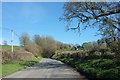
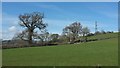
21 photos from this area
Area Information
Key information about the DT6 5PS including its size, population, and administrative classification.
- Area Type
- Postcode
- Area Size
- 17.0 hectares
- Population
- 2284
- Population Density
- 80 people/km²
House Prices in DT6 5PS
8
Properties
£255,125
Average Sold Price
£85,500
Lowest Price
£330,000
Highest Price
Showing 8 properties
| Address | Type | Beds | Baths | Last Sale Price | Last Sale Date | |
|---|---|---|---|---|---|---|
| Sea Glimpse, Pymore Lane, Dottery, DT6 5PS | house | - | - | £315,000 | Sep 2022 | |
| Winton Cottage, Pymore Lane, Dottery, DT6 5PS | Semi-detached | 3 | 2 | £290,000 | Nov 2019 | |
| Rosebarton, Pymore Lane, Dottery, DT6 5PS | house | - | - | £330,000 | Sep 2007 | |
| Three Chimneys, Pymore Lane, Dottery, DT6 5PS | Semi-detached | - | - | £85,500 | Jun 1997 | |
| The Ivys, Pymore Lane, Dottery, DT6 5PS | Detached | 3 | 2 | - | - | |
| The Willows, Pymore Lane, Dottery, DT6 5PS | Detached | - | - | - | - | |
| East Lea, Pymore Lane, Dottery, DT6 5PS | Terraced | - | - | - | - | |
| Allington View, Pymore Lane, Dottery, DT6 5PS | Terraced | - | - | - | - |
Energy Efficiency in DT6 5PS
Amenities
Schools
| Rank | School | Type | Entry gender | Ages |
|---|
Explore more schools in this area
Go to Schools tabDemographics
Household Size
Two person
most common
Accommodation Type
Houses
most common
Tenure
70
majority
Ethnic Group
White
most common
Religion
N/A
most common
Household Composition
N/A
most common
Age
47
median
Adults (30-64 years)
most common
Household Deprivation
N/A
with no deprivation
NS-SEC
33
in Lower managerial occupations
Explore more demographic insights in this area
Go to Demographics tabPlanning
Planning Constraints
- Flood RiskPremium
- Ramsar Wetland SitesPremium
- Area of Outstanding Natural BeautyPremium
- Protected Nature ReservePremium
- Protected WoodlandPremium