Area Overview for DT6 5BP
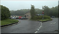
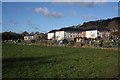
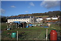
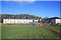
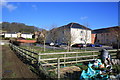
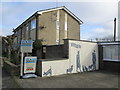
Photos of DT6 5BP


Area Information
Living in DT6 5BP offers a compact, residential experience shaped by its small cluster of homes and modest population of 1,741. This postcode area is defined by its focus on family-oriented living, with a median age of 47 and a majority of residents aged 30–64. The community is predominantly home-owning, though 45% of properties are owner-occupied, suggesting a mix of long-term residents and renters. The area’s character is rooted in its quiet, low-density housing stock, which contrasts with the proximity of nearby amenities like Bridport’s retail outlets and St Mary’s Primary School. While flood risk is negligible, residents should be mindful of the area’s medium crime risk, which aligns with average national rates. Daily life here balances practicality with accessibility, with local shops and schools within reach. The absence of protected natural sites or planning constraints means development is unlikely to disrupt the area’s existing layout. For those seeking a settled, low-maintenance environment with straightforward infrastructure, DT6 5BP provides a straightforward proposition.
- Area Type
- Postcode
- Area Size
- Not available
- Population
- Not available
- Population Density
- Not available
The property market in DT6 5BP is characterised by a predominance of houses, with no mention of flats or apartments in the data. At 45% home ownership, the area is not heavily skewed toward owner-occupation, indicating a notable presence of rental properties. This suggests a balance between long-term residents and those seeking temporary housing, which could influence property prices and availability. The focus on houses rather than high-density housing means the area is likely to appeal to families or individuals prioritising space and privacy. Buyers should consider the small size of the postcode area, which may limit options for those seeking larger estates or developments. The lack of planning constraints or protected sites means the housing stock is unlikely to face restrictions on expansion or renovation. For those evaluating the market, the mix of owner-occupied and rented properties could offer opportunities, though the modest population size may mean competition is limited.
House Prices in DT6 5BP
No properties found in this postcode.
Energy Efficiency in DT6 5BP
The lifestyle in DT6 5BP is supported by a selection of retail amenities within practical reach. Notable shops include Waitrose Bridport, Spar, and Morrisons Bridport, offering a range of grocery and convenience services. These stores cater to daily needs, from fresh produce to household essentials, reducing the necessity for long trips to larger centres. The presence of multiple retail options suggests a functional, community-focused approach to shopping, though the data does not mention dining or leisure facilities. The area’s small size means residents may need to travel slightly further for entertainment or specialist services. The retail landscape is straightforward, with no indication of high-end or niche establishments. For those valuing convenience and accessibility, the proximity of these shops enhances the practicality of daily life in DT6 5BP.
Amenities
Schools
The nearest school to DT6 5BP is Bridport, St Mary’s Church of England Primary School, which serves the local community with primary education. The school holds an Ofsted rating of ‘good’, indicating a satisfactory standard of teaching and student outcomes. As the sole listed school in the data, it is the primary educational institution for children in the area, though no secondary schools are mentioned. The presence of a primary school with a good rating is a key consideration for families, offering a stable foundation for early education. However, the absence of secondary schools or other educational facilities within the postcode means families may need to look beyond DT6 5BP for further schooling. The school’s rating suggests it meets basic expectations, but additional research would be needed to assess its performance in areas like exam results or extracurricular offerings.
| Rank | School | Type | Entry gender | Ages |
|---|
Explore more schools in this area
Go to Schools tabDemographics
The population of DT6 5BP is predominantly composed of adults aged 30–64, reflecting a median age of 47. This suggests a community of established professionals and families, with fewer younger or older residents. Home ownership stands at 45%, indicating a significant portion of the housing stock is rented, which may appeal to those seeking flexibility. The area’s accommodation is almost entirely composed of houses, rather than flats or apartments, reinforcing a suburban or semi-rural feel. The predominant ethnic group is White, with no specific data on other demographics provided. The age profile and home ownership rate suggest a stable, long-term community, though the 45% rental rate implies a degree of turnover. For quality of life, the absence of deprivation data means it is unclear whether the area faces socioeconomic challenges, but the lack of protected sites or environmental risks points to a straightforward living environment.
Household Size
Accommodation Type
Tenure
Ethnic Group
Religion
Household Composition
Age
Household Deprivation
NS-SEC
Explore more demographic insights in this area
Go to Demographics tabPlanning
Planning Constraints
- Flood RiskPremium
- Ramsar Wetland SitesPremium
- Area of Outstanding Natural BeautyPremium
- Protected Nature ReservePremium
- Protected WoodlandPremium