Area Overview for DT6 4QN
Photos of DT6 4QN

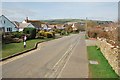


22 photos from this area
Area Information
Key information about the DT6 4QN including its size, population, and administrative classification.
- Area Type
- Postcode
- Area Size
- 33.9 hectares
- Population
- 1848
- Population Density
- 57 people/km²
House Prices in DT6 4QN
36
Properties
£477,667
Average Sold Price
£17,000
Lowest Price
£900,000
Highest Price
Showing 36 properties
| Address | Type | Beds | Baths | Last Sale Price | Last Sale Date | |
|---|---|---|---|---|---|---|
| 20 Annings Lane, Burton Bradstock, DT6 4QN | Terraced | 3 | 2 | £415,000 | Jun 2024 | |
| 37 Annings Lane, Burton Bradstock, DT6 4QN | Detached | 5 | 2 | £675,000 | Jun 2024 | |
| 33 Annings Lane, Burton Bradstock, DT6 4QN | Detached | 4 | 2 | £790,000 | Feb 2023 | |
| 19 Annings Lane, Burton Bradstock, DT6 4QN | Terraced | 3 | 1 | £472,000 | Sep 2022 | |
| Little Orchard, Annings Lane, Burton Bradstock, DT6 4QN | Bungalow | - | - | £700,000 | May 2022 | |
| 29 Annings Lane, Burton Bradstock, DT6 4QN | house | - | - | £876,000 | Jun 2021 | |
| 31 Annings Lane, Burton Bradstock, DT6 4QN | Bungalow | 3 | - | £900,000 | Jun 2021 | |
| 35 Annings Lane, Burton Bradstock, DT6 4QN | Bungalow | - | - | £770,000 | Feb 2021 | |
| Millfield, Annings Lane, Burton Bradstock, DT6 4QN | Bungalow | - | - | £700,000 | Nov 2020 | |
| Piffer, Annings Lane, Burton Bradstock, DT6 4QN | Bungalow | - | - | £635,000 | Nov 2019 |
Page 1 of 4
Energy Efficiency in DT6 4QN
Amenities
Schools
| Rank | School | Type | Entry gender | Ages |
|---|
Explore more schools in this area
Go to Schools tabDemographics
Household Size
Two person
most common
Accommodation Type
Houses
most common
Tenure
77
majority
Ethnic Group
White
most common
Religion
N/A
most common
Household Composition
N/A
most common
Age
47
median
Elderly (65+ years)
most common
Household Deprivation
N/A
with no deprivation
NS-SEC
41
in Lower managerial occupations
Explore more demographic insights in this area
Go to Demographics tabPlanning
Planning Constraints
- Flood RiskPremium
- Ramsar Wetland SitesPremium
- Area of Outstanding Natural BeautyPremium
- Protected Nature ReservePremium
- Protected WoodlandPremium