Area Overview for DT6 4NY
Photos of DT6 4NY
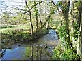

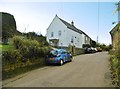
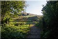
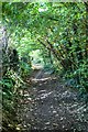
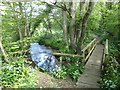
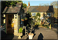
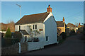
64 photos from this area
Area Information
Key information about the DT6 4NY including its size, population, and administrative classification.
- Area Type
- Postcode
- Area Size
- 26.1 hectares
- Population
- 1747
- Population Density
- 47 people/km²
House Prices in DT6 4NY
15
Properties
£572,350
Average Sold Price
£85,000
Lowest Price
£1,550,000
Highest Price
Showing 15 properties
| Address | Type | Beds | Baths | Last Sale Price | Last Sale Date | |
|---|---|---|---|---|---|---|
| Hillview, New Road, Uploders, DT6 4NY | Bungalow | 3 | 1 | £510,000 | Nov 2024 | |
| Adams Barn, New Road, Uploders, DT6 4NY | Detached | 3 | 3 | £1,065,000 | Nov 2023 | |
| Trelee, New Road, Uploders, DT6 4NY | Bungalow | 3 | 3 | £594,000 | Jun 2023 | |
| Sweetbriar Farm, New Road, Uploders, DT6 4NY | house | - | - | £1,550,000 | Apr 2021 | |
| Old Parish Hall, New Road, Uploders, DT6 4NY | house | - | - | £415,000 | Jan 2021 | |
| Crows Nest, New Road, Uploders, DT6 4NY | Detached | 3 | 2 | £277,500 | Jul 2019 | |
| Hillside, New Road, Uploders, DT6 4NY | Detached | - | - | £425,000 | Jun 2015 | |
| Inglewood, New Road, Uploders, DT6 4NY | Bungalow | - | - | £197,000 | Dec 2013 | |
| Sunleaze, New Road, Uploders, DT6 4NY | Bungalow | - | - | £605,000 | Nov 2010 | |
| Hedgerow, New Road, Uploders, DT6 4NY | house | 4 | 2 | £85,000 | Oct 2001 |
Page 1 of 2
Energy Efficiency in DT6 4NY
Amenities
Schools
| Rank | School | Type | Entry gender | Ages |
|---|
Explore more schools in this area
Go to Schools tabDemographics
Household Size
Two person
most common
Accommodation Type
Houses
most common
Tenure
74
majority
Ethnic Group
White
most common
Religion
N/A
most common
Household Composition
N/A
most common
Age
47
median
Adults (30-64 years)
most common
Household Deprivation
N/A
with no deprivation
NS-SEC
38
in Lower managerial occupations
Explore more demographic insights in this area
Go to Demographics tabPlanning
Planning Constraints
- Flood RiskPremium
- Ramsar Wetland SitesPremium
- Area of Outstanding Natural BeautyPremium
- Protected Nature ReservePremium
- Protected WoodlandPremium