Area Overview for DT6 4AJ
Photos of DT6 4AJ


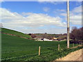
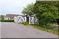

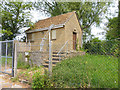
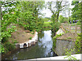
44 photos from this area
Area Information
Key information about the DT6 4AJ including its size, population, and administrative classification.
- Area Type
- Postcode
- Area Size
- 16.9 hectares
- Population
- 2059
- Population Density
- 737 people/km²
House Prices in DT6 4AJ
15
Properties
£335,938
Average Sold Price
£85,000
Lowest Price
£620,000
Highest Price
Showing 15 properties
| Address | Type | Beds | Baths | Last Sale Price | Last Sale Date | |
|---|---|---|---|---|---|---|
| Carloway, Lee Lane, Bridport, DT6 4AJ | Detached | - | - | £324,000 | Sep 2020 | |
| The Firs, Lee Lane, Bridport, DT6 4AJ | Detached | - | - | £620,000 | Nov 2017 | |
| Lee Top, Lee Lane, Bridport, DT6 4AJ | house | - | - | £510,000 | Aug 2015 | |
| Ridgeway, Lee Lane, Bridport, DT6 4AJ | Detached | - | - | £450,000 | Jun 2010 | |
| Highmead, Lee Lane, Bridport, DT6 4AJ | Detached | - | - | £330,000 | Oct 2007 | |
| St Anthony, Lee Lane, Bridport, DT6 4AJ | Detached | - | - | £227,000 | Aug 2006 | |
| The Patch, Lee Lane, Bridport, DT6 4AJ | Detached | - | - | £85,000 | Apr 1999 | |
| High Acres, Lee Lane, Bridport, DT6 4AJ | Detached | 4 | - | £141,500 | Jul 1995 | |
| Wits End, Lee Lane, Bridport, DT6 4AJ | Bungalow | - | - | - | - | |
| Springfield, Lee Lane, Bridport, DT6 4AJ | Detached | - | - | - | - |
Page 1 of 2
Energy Efficiency in DT6 4AJ
Amenities
Schools
| Rank | School | Type | Entry gender | Ages |
|---|
Explore more schools in this area
Go to Schools tabDemographics
Household Size
Two person
most common
Accommodation Type
Houses
most common
Tenure
77
majority
Ethnic Group
White
most common
Religion
N/A
most common
Household Composition
N/A
most common
Age
47
median
Adults (30-64 years)
most common
Household Deprivation
N/A
with no deprivation
NS-SEC
34
in Lower managerial occupations
Explore more demographic insights in this area
Go to Demographics tabPlanning
Planning Constraints
- Flood RiskPremium
- Ramsar Wetland SitesPremium
- Area of Outstanding Natural BeautyPremium
- Protected Nature ReservePremium
- Protected WoodlandPremium