Area Overview for DT6 3SL
Photos of DT6 3SL
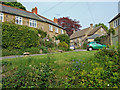
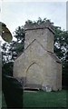
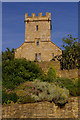
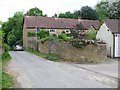
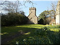
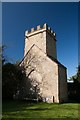
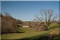
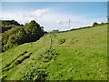
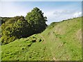
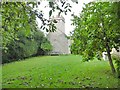
70 photos from this area
Area Information
Key information about the DT6 3SL including its size, population, and administrative classification.
- Area Type
- Postcode
- Area Size
- 85.1 hectares
- Population
- 1747
- Population Density
- 47 people/km²
House Prices in DT6 3SL
29
Properties
£428,038
Average Sold Price
£120,000
Lowest Price
£750,000
Highest Price
Showing 29 properties
| Address | Type | Beds | Baths | Last Sale Price | Last Sale Date | |
|---|---|---|---|---|---|---|
| Church Farm, Ruscombe Lane, West Milton, DT6 3SL | house | - | - | £750,000 | May 2023 | |
| The Finches, Ruscombe Lane, West Milton, DT6 3SL | Bungalow | 3 | 2 | £600,000 | Dec 2022 | |
| Leopard Meadow, Ruscombe Lane, West Milton, DT6 3SL | Bungalow | 3 | 2 | £600,000 | Dec 2022 | |
| Brownstones, Ruscombe Lane, West Milton, DT6 3SL | Bungalow | - | - | £320,000 | Aug 2020 | |
| Campions, Ruscombe Lane, West Milton, DT6 3SL | Bungalow | 3 | 1 | £445,000 | Feb 2017 | |
| Woodridings, Ruscombe Lane, West Milton, DT6 3SL | Bungalow | 3 | - | £330,000 | Dec 2012 | |
| Lynch Dairy Mead, Ruscombe Lane, West Milton, DT6 3SL | house | - | - | £495,000 | Mar 2011 | |
| Ruscombe House, Ruscombe Lane, West Milton, DT6 3SL | Detached | 4 | 3 | £575,000 | Oct 2009 | |
| Blenheim Cottage, Ruscombe Lane, West Milton, DT6 3SL | Detached | 3 | 3 | £315,000 | May 2007 | |
| Leopard Cottage, Ruscombe Lane, West Milton, DT6 3SL | Detached | - | - | £500,000 | Oct 2006 |
Page 1 of 3
Energy Efficiency in DT6 3SL
Amenities
Schools
| Rank | School | Type | Entry gender | Ages |
|---|
Explore more schools in this area
Go to Schools tabDemographics
Household Size
Two person
most common
Accommodation Type
Houses
most common
Tenure
74
majority
Ethnic Group
White
most common
Religion
N/A
most common
Household Composition
N/A
most common
Age
47
median
Adults (30-64 years)
most common
Household Deprivation
N/A
with no deprivation
NS-SEC
38
in Lower managerial occupations
Explore more demographic insights in this area
Go to Demographics tabPlanning
Planning Constraints
- Flood RiskPremium
- Ramsar Wetland SitesPremium
- Area of Outstanding Natural BeautyPremium
- Protected Nature ReservePremium
- Protected WoodlandPremium