Area Overview for DT6 3SA
Photos of DT6 3SA
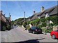
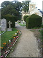
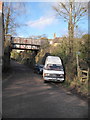
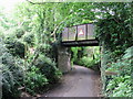
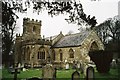
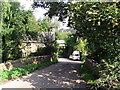
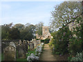
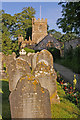
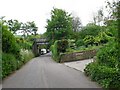
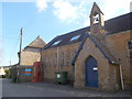
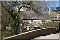
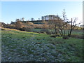
51 photos from this area
Area Information
Key information about the DT6 3SA including its size, population, and administrative classification.
- Area Type
- Postcode
- Area Size
- 28.1 hectares
- Population
- 1747
- Population Density
- 47 people/km²
House Prices in DT6 3SA
45
Properties
£677,650
Average Sold Price
£165,000
Lowest Price
£1,875,000
Highest Price
Showing 45 properties
| Address | Type | Beds | Baths | Last Sale Price | Last Sale Date | |
|---|---|---|---|---|---|---|
| Waynflete, Main Street, Loders, DT6 3SA | Detached | 4 | 1 | £309,500 | Jul 2025 | |
| Farmers Arms, Main Street, Loders, DT6 3SA | Semi-detached | - | - | £1,100,000 | Dec 2021 | |
| West Combe, Smishops Lane, Loders, DT6 3SA | house | - | - | £1,350,000 | Dec 2021 | |
| The Barn House, Main Street, Loders, DT6 3SA | house | - | - | £1,875,000 | Sep 2021 | |
| Church Farm Cottage, Main Street, Loders, DT6 3SA | house | - | - | £390,000 | Oct 2018 | |
| Church Farm House, Main Street, Loders, DT6 3SA | Detached | 3 | 2 | £505,000 | Mar 2017 | |
| Lothers, Main Street, Loders, DT6 3SA | house | - | - | £382,000 | Oct 2010 | |
| 20 Main Street, Loders, DT6 3SA | Detached | - | - | £450,000 | Nov 2009 | |
| Post Farm, 27 Main Street, Loders, DT6 3SA | Detached | - | - | £165,000 | Oct 2008 | |
| Pound Cottage, Main Street, Loders, DT6 3SA | house | - | - | £250,000 | Apr 1999 |
Page 1 of 5
Energy Efficiency in DT6 3SA
Amenities
Schools
| Rank | School | Type | Entry gender | Ages |
|---|
Explore more schools in this area
Go to Schools tabDemographics
Household Size
Two person
most common
Accommodation Type
Houses
most common
Tenure
74
majority
Ethnic Group
White
most common
Religion
N/A
most common
Household Composition
N/A
most common
Age
47
median
Adults (30-64 years)
most common
Household Deprivation
N/A
with no deprivation
NS-SEC
38
in Lower managerial occupations
Explore more demographic insights in this area
Go to Demographics tabPlanning
Planning Constraints
- Flood RiskPremium
- Ramsar Wetland SitesPremium
- Area of Outstanding Natural BeautyPremium
- Protected Nature ReservePremium
- Protected WoodlandPremium