Area Overview for DT5 2JD
Photos of DT5 2JD
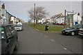
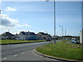
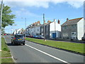


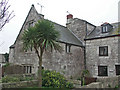

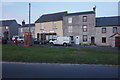


98 photos from this area
Area Information
Key information about the DT5 2JD including its size, population, and administrative classification.
- Area Type
- Postcode
- Area Size
- 2.1 hectares
- Population
- 1612
- Population Density
- 1234 people/km²
House Prices in DT5 2JD
26
Properties
£111,957
Average Sold Price
£22,500
Lowest Price
£240,000
Highest Price
Showing 26 properties
| Address | Type | Beds | Baths | Last Sale Price | Last Sale Date | |
|---|---|---|---|---|---|---|
| 10 Martinscroft Road, Portland, DT5 2JD | Terraced | 3 | 1 | £240,000 | Jul 2024 | |
| 9, Curtis Court, Martinscroft Road, Portland, DT5 2JD | Flat | - | - | £130,000 | Nov 2023 | |
| 8 Martinscroft Road, Portland, DT5 2JD | Terraced | 3 | 1 | £236,000 | Nov 2022 | |
| 23, Rickard House, Martinscroft Road, Portland, DT5 2JD | Flat | - | - | £118,000 | Nov 2022 | |
| 19, Rickard House, Martinscroft Road, Portland, DT5 2JD | Flat | - | - | £110,000 | Apr 2021 | |
| 24, Cornwell Court, Martinscroft Road, Portland, DT5 2JD | Flat | - | - | £112,000 | Dec 2019 | |
| 2 Martinscroft Road, Portland, DT5 2JD | Terraced | 3 | 1 | £195,000 | Sep 2019 | |
| 11, Curtis Court, Martinscroft Road, Portland, DT5 2JD | Flat | - | - | £110,000 | May 2017 | |
| 7, Curtis Court, Martinscroft Road, Portland, DT5 2JD | Flat | 2 | 1 | £102,000 | Mar 2016 | |
| 1 Martinscroft Road, Portland, DT5 2JD | Terraced | 3 | 1 | £147,000 | Dec 2014 |
Page 1 of 3
Energy Efficiency in DT5 2JD
Amenities
Schools
| Rank | School | Type | Entry gender | Ages |
|---|
Explore more schools in this area
Go to Schools tabDemographics
Household Size
Two person
most common
Accommodation Type
Houses
most common
Tenure
61
majority
Ethnic Group
White
most common
Religion
N/A
most common
Household Composition
N/A
most common
Age
47
median
Adults (30-64 years)
most common
Household Deprivation
N/A
with no deprivation
NS-SEC
20
in Lower managerial occupations
Explore more demographic insights in this area
Go to Demographics tabPlanning
Planning Constraints
- Flood RiskPremium
- Ramsar Wetland SitesPremium
- Area of Outstanding Natural BeautyPremium
- Protected Nature ReservePremium
- Protected WoodlandPremium