Area Overview for DT5 2DS
Photos of DT5 2DS
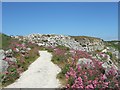
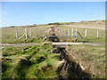
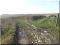
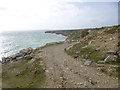
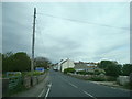
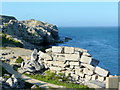
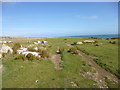
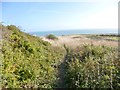
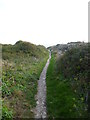

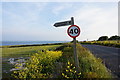

96 photos from this area
Area Information
Key information about the DT5 2DS including its size, population, and administrative classification.
- Area Type
- Postcode
- Area Size
- 21.0 hectares
- Population
- 2055
- Population Density
- 659 people/km²
House Prices in DT5 2DS
34
Properties
£308,029
Average Sold Price
£70,000
Lowest Price
£510,000
Highest Price
Showing 34 properties
| Address | Type | Beds | Baths | Last Sale Price | Last Sale Date | |
|---|---|---|---|---|---|---|
| 40 Sweet Hill Road, Portland, DT5 2DS | Bungalow | 3 | 2 | £465,000 | Apr 2025 | |
| 42 Sweet Hill Road, Portland, DT5 2DS | Bungalow | 3 | 2 | £470,000 | Mar 2025 | |
| 23 Sweet Hill Road, Portland, DT5 2DS | Semi-detached | 3 | 1 | £405,000 | Feb 2024 | |
| 46 Sweet Hill Road, Portland, DT5 2DS | Bungalow | 4 | 2 | £400,000 | Jan 2024 | |
| 16 Sweet Hill Road, Portland, DT5 2DS | Detached | 3 | 2 | £410,000 | Jul 2023 | |
| 50 Sweet Hill Road, Portland, DT5 2DS | Bungalow | 4 | 3 | £510,000 | Oct 2022 | |
| 22 Sweet Hill Road, Portland, DT5 2DS | house | - | - | £368,000 | Jun 2021 | |
| 11 Sweet Hill Road, Portland, DT5 2DS | Detached | 3 | - | £265,000 | Mar 2021 | |
| 36 Sweet Hill Road, Portland, DT5 2DS | Detached | 4 | 2 | £430,000 | Aug 2018 | |
| 12 Sweet Hill Road, Portland, DT5 2DS | Detached | 4 | 3 | £291,700 | Apr 2015 |
Page 1 of 4
Energy Efficiency in DT5 2DS
Amenities
Schools
| Rank | School | Type | Entry gender | Ages |
|---|
Explore more schools in this area
Go to Schools tabDemographics
Household Size
Two person
most common
Accommodation Type
Houses
most common
Tenure
83
majority
Ethnic Group
White
most common
Religion
N/A
most common
Household Composition
N/A
most common
Age
47
median
Adults (30-64 years)
most common
Household Deprivation
N/A
with no deprivation
NS-SEC
30
in Lower managerial occupations
Explore more demographic insights in this area
Go to Demographics tabPlanning
Planning Constraints
- Flood RiskPremium
- Ramsar Wetland SitesPremium
- Area of Outstanding Natural BeautyPremium
- Protected Nature ReservePremium
- Protected WoodlandPremium