Area Overview for DT3 5NA
Photos of DT3 5NA

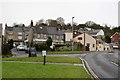
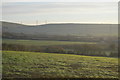
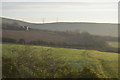
43 photos from this area
Area Information
Key information about the DT3 5NA including its size, population, and administrative classification.
- Area Type
- Postcode
- Area Size
- 2.3 hectares
- Population
- 2154
- Population Density
- 4963 people/km²
House Prices in DT3 5NA
42
Properties
£208,718
Average Sold Price
£55,000
Lowest Price
£288,000
Highest Price
Showing 42 properties
| Address | Type | Beds | Baths | Last Sale Price | Last Sale Date | |
|---|---|---|---|---|---|---|
| 8 Chapel Lane, Weymouth, DT3 5NA | Terraced | 2 | 1 | £270,000 | Sep 2025 | |
| 32 Chapel Lane, Weymouth, DT3 5NA | Terraced | 2 | 1 | £172,500 | Mar 2025 | |
| 30 Chapel Lane, Weymouth, DT3 5NA | Semi-detached | - | - | £149,500 | Mar 2024 | |
| 28 Chapel Lane, Weymouth, DT3 5NA | Semi-detached | 3 | 1 | £267,000 | May 2021 | |
| Aleph, Chapel Lane, Weymouth, DT3 5NA | Bungalow | - | - | £230,000 | Dec 2020 | |
| 23 Chapel Lane, Weymouth, DT3 5NA | Semi-detached | 3 | 1 | £275,000 | Oct 2020 | |
| 4 Chapel Lane, Weymouth, DT3 5NA | Flat | 1 | 1 | £120,000 | Dec 2019 | |
| 26 Chapel Lane, Weymouth, DT3 5NA | Semi-detached | 5 | 2 | £288,000 | Dec 2018 | |
| Tara, Chapel Lane, Weymouth, DT3 5NA | Bungalow | 3 | 1 | £270,000 | Sep 2017 | |
| 27 Chapel Lane, Weymouth, DT3 5NA | Semi-detached | 2 | 1 | £187,495 | Jan 2016 |
Page 1 of 5
Energy Efficiency in DT3 5NA
Amenities
Schools
| Rank | School | Type | Entry gender | Ages |
|---|
Explore more schools in this area
Go to Schools tabDemographics
Household Size
Two person
most common
Accommodation Type
Houses
most common
Tenure
62
majority
Ethnic Group
White
most common
Religion
N/A
most common
Household Composition
N/A
most common
Age
47
median
Adults (30-64 years)
most common
Household Deprivation
N/A
with no deprivation
NS-SEC
29
in Lower managerial occupations
Explore more demographic insights in this area
Go to Demographics tabPlanning
Planning Constraints
- Flood RiskPremium
- Ramsar Wetland SitesPremium
- Area of Outstanding Natural BeautyPremium
- Protected Nature ReservePremium
- Protected WoodlandPremium