Area Overview for DT2 8XP
Photos of DT2 8XP
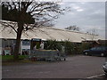

![Owermoigne village [1] in DT2 8XP](https://images.propbar.co.uk/images/geograph/72/52/7252524_120.jpg)
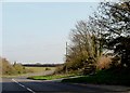
![Owermoigne village [2] in DT2 8XP](https://images.propbar.co.uk/images/geograph/72/52/7252525_120.jpg)
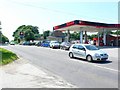
![Owermoigne village [3] in DT2 8XP](https://images.propbar.co.uk/images/geograph/72/52/7252526_120.jpg)
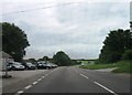
![Owermoigne village [4] in DT2 8XP](https://images.propbar.co.uk/images/geograph/72/52/7252527_120.jpg)
![Owermoigne village [5] in DT2 8XP](https://images.propbar.co.uk/images/geograph/72/52/7252530_120.jpg)
![Owermoigne village [6] in DT2 8XP](https://images.propbar.co.uk/images/geograph/72/52/7252531_120.jpg)
![Owermoigne village [7] in DT2 8XP](https://images.propbar.co.uk/images/geograph/72/52/7252536_120.jpg)
13 photos from this area
Area Information
Key information about the DT2 8XP including its size, population, and administrative classification.
- Area Type
- Postcode
- Area Size
- 2.5 hectares
- Population
- 2108
- Population Density
- 55 people/km²
House Prices in DT2 8XP
15
Properties
£398,292
Average Sold Price
£127,000
Lowest Price
£595,000
Highest Price
Showing 15 properties
| Address | Type | Beds | Baths | Last Sale Price | Last Sale Date | |
|---|---|---|---|---|---|---|
| 10 East Farm Lane, Owermoigne, DT2 8XP | Detached | 4 | 2 | £475,000 | Sep 2024 | |
| 9 East Farm Lane, Owermoigne, DT2 8XP | Detached | 4 | 2 | £510,000 | Apr 2024 | |
| 5A East Farm Lane, Owermoigne, DT2 8XP | Land | - | - | £527,500 | Dec 2021 | |
| 7 East Farm Lane, Owermoigne, DT2 8XP | house | - | - | £435,000 | May 2021 | |
| 12 East Farm Lane, Owermoigne, DT2 8XP | house | - | - | £450,000 | May 2021 | |
| 8 East Farm Lane, Owermoigne, DT2 8XP | house | - | - | £595,000 | Apr 2021 | |
| 11 East Farm Lane, Owermoigne, DT2 8XP | Retail | 4 | 2 | £175,000 | Aug 2019 | |
| 4 East Farm Lane, Owermoigne, DT2 8XP | house | - | - | £375,000 | Jul 2019 | |
| 2 East Farm Lane, Owermoigne, DT2 8XP | Detached | 4 | 2 | £520,000 | Oct 2018 | |
| 1 East Farm Lane, Owermoigne, DT2 8XP | house | - | - | £415,000 | Nov 2009 |
Page 1 of 2
Energy Efficiency in DT2 8XP
Amenities
Schools
| Rank | School | Type | Entry gender | Ages |
|---|
Explore more schools in this area
Go to Schools tabDemographics
Household Size
Two person
most common
Accommodation Type
Houses
most common
Tenure
76
majority
Ethnic Group
White
most common
Religion
N/A
most common
Household Composition
N/A
most common
Age
47
median
Adults (30-64 years)
most common
Household Deprivation
N/A
with no deprivation
NS-SEC
38
in Lower managerial occupations
Explore more demographic insights in this area
Go to Demographics tabPlanning
Planning Constraints
- Flood RiskPremium
- Ramsar Wetland SitesPremium
- Area of Outstanding Natural BeautyPremium
- Protected Nature ReservePremium
- Protected WoodlandPremium