Area Overview for DT2 8WP
Photos of DT2 8WP
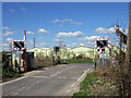
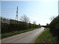
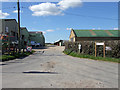
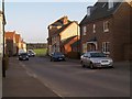
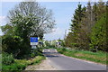

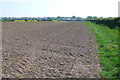
7 photos from this area
Area Information
Key information about the DT2 8WP including its size, population, and administrative classification.
- Area Type
- Postcode
- Area Size
- 6662 m²
- Population
- 1857
- Population Density
- 190 people/km²
House Prices in DT2 8WP
14
Properties
£289,125
Average Sold Price
£188,000
Lowest Price
£437,750
Highest Price
Showing 14 properties
| Address | Type | Beds | Baths | Last Sale Price | Last Sale Date | |
|---|---|---|---|---|---|---|
| 7 Frome Valley Road, Crossways, DT2 8WP | Detached | 3 | 2 | £382,500 | Aug 2025 | |
| 46 Frome Valley Road, Crossways, DT2 8WP | Detached | 4 | 3 | £437,750 | Aug 2021 | |
| 36 Frome Valley Road, Crossways, DT2 8WP | Semi-detached | 3 | 1 | £265,000 | Jul 2019 | |
| 5 Frome Valley Road, Crossways, DT2 8WP | Detached | 5 | 3 | £391,000 | Feb 2019 | |
| 38 Frome Valley Road, Crossways, DT2 8WP | Semi-detached | 3 | 1 | £270,000 | Jul 2018 | |
| 9 Frome Valley Road, Crossways, DT2 8WP | house | - | - | £198,000 | Dec 2015 | |
| 11 Frome Valley Road, Crossways, DT2 8WP | Terraced | 3 | - | £188,000 | Jan 2014 | |
| 42 Frome Valley Road, Crossways, DT2 8WP | Detached | 3 | 2 | £242,000 | Apr 2013 | |
| 13 Frome Valley Road, Crossways, DT2 8WP | Terraced | - | - | £191,500 | Jun 2007 | |
| 44 Frome Valley Road, Crossways, DT2 8WP | Detached | 4 | 3 | £322,000 | Sep 2006 |
Page 1 of 2
Energy Efficiency in DT2 8WP
Amenities
Schools
| Rank | School | Type | Entry gender | Ages |
|---|
Explore more schools in this area
Go to Schools tabDemographics
Household Size
Two person
most common
Accommodation Type
Houses
most common
Tenure
72
majority
Ethnic Group
White
most common
Religion
N/A
most common
Household Composition
N/A
most common
Age
47
median
Adults (30-64 years)
most common
Household Deprivation
N/A
with no deprivation
NS-SEC
34
in Lower managerial occupations
Explore more demographic insights in this area
Go to Demographics tabPlanning
Planning Constraints
- Flood RiskPremium
- Ramsar Wetland SitesPremium
- Area of Outstanding Natural BeautyPremium
- Protected Nature ReservePremium
- Protected WoodlandPremium