Area Overview for DT2 8SA
Photos of DT2 8SA


Area Information
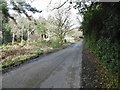
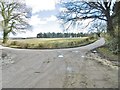
Living in DT2 8SA means inhabiting a compact, residential cluster in England’s rural heartland. The area spans 41.3 hectares, housing 2,582 people at a density of 42 per square kilometre — a quiet, low-key community. This postcode is defined by its small-scale charm, with homes predominantly set in a traditional, low-density layout. Daily life here is shaped by proximity to nearby towns and a mix of local amenities. While not a bustling urban hub, DT2 8SA offers a peaceful alternative for those seeking a slower pace, with easy access to rail links and a network of schools. The area’s character is rooted in its demographic profile: a mature population, largely aged 30–64, with strong home ownership. For buyers, this means a stable, established community where property values are likely to reflect long-term residency and local attachment. The absence of major planning constraints or environmental risks adds to its appeal, though the presence of protected woodland nearby may influence future development.
- Area Type
- Postcode
- Area Size
- 41.3 hectares
- Population
- 2582
- Population Density
- 42 people/km²
DT2 8SA is a predominantly owner-occupied area, with 73% of properties in private hands. This contrasts with rental markets where landlords dominate, suggesting a community of long-term residents who have invested in their homes. The accommodation type is exclusively houses, which aligns with the area’s low-density, rural character. This means buyers should expect a limited selection of properties, as the small 41.3-hectare footprint restricts development. The absence of flats or high-rise buildings also implies a focus on family-friendly, spacious living. For those seeking a home here, the market is likely to be competitive, with properties holding value due to their scarcity. Proximity to nearby towns and rail links may also influence property prices, as buyers balance the appeal of rural living with access to urban amenities.
House Prices in DT2 8SA
Showing 1 properties
| Address | Type | Beds | Baths | Last Sale Price | Last Sale Date | |
|---|---|---|---|---|---|---|
| Tennis 293M From 12 Kingsmead 73M From Unnamed Road, Beacon Corner To White Hill Junction Coombe Road, Puddletown, DT2 8SA | Leisure | - | - | - | - |
Energy Efficiency in DT2 8SA
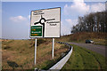
Daily life in DT2 8SA is shaped by its proximity to local shops and transport hubs. Retail options include Spar Puddletown, Co-op Warmwell, and Cook Dorchester, offering essentials within a short reach. These venues contribute to a self-sufficient lifestyle, reducing the need for long commutes to larger centres. The rail network, with stations at Moreton, Dorchester South, and Dorchester West, adds convenience for travel, whether for work, shopping, or leisure. While the area lacks large supermarkets or entertainment venues, its small-scale amenities foster a sense of community. The presence of multiple schools and low population density also means a quieter, more intimate environment. For those who value local charm over sprawling urban sprawl, DT2 8SA provides a blend of practicality and rural tranquillity.
Amenities
Schools
Families in DT2 8SA have access to a range of primary schools, including Cheselbourne Village School, which holds a ‘good’ Ofsted rating, and St Mary’s Church of England Middle School, Puddletown, which is an academy with the same rating. Puddletown Church of England First School appears twice in the data, once as a traditional school and once as an academy. This mix of school types offers parents options, from established local institutions to academies with potentially different curricula or governance structures. The presence of multiple schools within practical reach suggests a well-served educational landscape for young children. However, no secondary schools are listed, so families may need to look to nearby towns for comprehensive schooling. The ‘good’ Ofsted ratings indicate that at least some schools meet or exceed national standards, which is a positive factor for homebuyers prioritising education.
| Rank | School | Type | Entry gender | Ages |
|---|
Explore more schools in this area
Go to Schools tabDemographics
The population of DT2 8SA is predominantly adults aged 30–64, with a median age of 47. This suggests a community of long-term residents, many of whom are likely to be in their prime working years or nearing retirement. Home ownership is high, at 73%, indicating a stable housing market with limited rental activity. The area is characterised by houses rather than flats, reflecting a preference for traditional, family-oriented living. The predominant ethnic group is White, though no specific data on diversity or deprivation is provided. The low population density of 42 people per square kilometre reinforces the area’s rural, spread-out nature. For those considering relocation, this profile hints at a community that values stability, with residents likely to have strong ties to the local area. The absence of younger demographics or transient populations suggests a focus on established households rather than growing families or student populations.
Household Size
Accommodation Type
Tenure
Ethnic Group
Religion
Household Composition
Age
Household Deprivation
NS-SEC
Explore more demographic insights in this area
Go to Demographics tabPlanning
Planning Constraints
- Flood RiskPremium
- Ramsar Wetland SitesPremium
- Area of Outstanding Natural BeautyPremium
- Protected Nature ReservePremium
- Protected WoodlandPremium