Area Overview for DT2 8PG
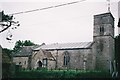
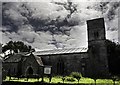
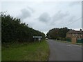
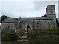
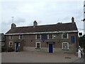
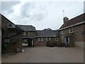
Photos of DT2 8PG
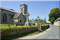
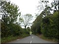
![West Knighton village [2] in DT2 8PG](https://images.propbar.co.uk/images/geograph/72/62/7262364_120.jpg)
![West Knighton village [3] in DT2 8PG](https://images.propbar.co.uk/images/geograph/72/62/7262365_120.jpg)
![West Knighton village [4] in DT2 8PG](https://images.propbar.co.uk/images/geograph/72/62/7262368_120.jpg)
![West Knighton village [5] in DT2 8PG](https://images.propbar.co.uk/images/geograph/72/62/7262375_120.jpg)
37 photos from this area
Area Information
Key information about the DT2 8PG including its size, population, and administrative classification.
- Area Type
- Postcode
- Area Size
- 1.7 hectares
- Population
- 1949
- Population Density
- 115 people/km²
House Prices in DT2 8PG
20
Properties
£186,440
Average Sold Price
£82,250
Lowest Price
£304,500
Highest Price
Showing 20 properties
| Address | Type | Beds | Baths | Last Sale Price | Last Sale Date | |
|---|---|---|---|---|---|---|
| 10 Glebe Way, West Knighton, DT2 8PG | house | - | - | £215,000 | Aug 2018 | |
| 7 Glebe Way, West Knighton, DT2 8PG | Terraced | 2 | 1 | £200,500 | Jan 2018 | |
| Halton House, Knighton Lane, West Knighton, DT2 8PG | Detached | - | - | £304,500 | Dec 2005 | |
| 16 Glebe Way, West Knighton, DT2 8PG | Bungalow | - | - | £129,950 | Mar 2004 | |
| Grendon, Glebe Way, West Knighton, DT2 8PG | Detached | - | - | £82,250 | Apr 1995 | |
| 3 Glebe Way, West Knighton, DT2 8PG | house | - | - | - | - | |
| 12 Glebe Way, West Knighton, DT2 8PG | house | - | - | - | - | |
| 6 Glebe Way, West Knighton, DT2 8PG | house | - | - | - | - | |
| 9 Glebe Way, West Knighton, DT2 8PG | house | - | - | - | - | |
| 8 Glebe Way, West Knighton, DT2 8PG | house | - | - | - | - |
Page 1 of 2
Energy Efficiency in DT2 8PG
Amenities
Schools
| Rank | School | Type | Entry gender | Ages |
|---|
Explore more schools in this area
Go to Schools tabDemographics
Household Size
Two person
most common
Accommodation Type
Houses
most common
Tenure
81
majority
Ethnic Group
White
most common
Religion
N/A
most common
Household Composition
N/A
most common
Age
47
median
Adults (30-64 years)
most common
Household Deprivation
N/A
with no deprivation
NS-SEC
44
in Lower managerial occupations
Explore more demographic insights in this area
Go to Demographics tabPlanning
Planning Constraints
- Flood RiskPremium
- Ramsar Wetland SitesPremium
- Area of Outstanding Natural BeautyPremium
- Protected Nature ReservePremium
- Protected WoodlandPremium