Area Overview for DT2 8ER
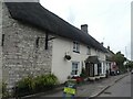
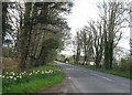
Photos of DT2 8ER
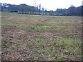
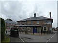
![Broadmayne houses [1] in DT2 8ER](https://images.propbar.co.uk/images/geograph/72/61/7261432_120.jpg)
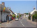
![Broadmayne houses [8] in DT2 8ER](https://images.propbar.co.uk/images/geograph/72/62/7262334_120.jpg)
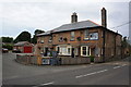
![Broadmayne houses [9] in DT2 8ER](https://images.propbar.co.uk/images/geograph/72/62/7262336_120.jpg)
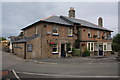
![Broadmayne houses [10] in DT2 8ER](https://images.propbar.co.uk/images/geograph/72/62/7262337_120.jpg)

26 photos from this area
Area Information
Key information about the DT2 8ER including its size, population, and administrative classification.
- Area Type
- Postcode
- Area Size
- 3.4 hectares
- Population
- 1949
- Population Density
- 115 people/km²
House Prices in DT2 8ER
16
Properties
£249,250
Average Sold Price
£93,000
Lowest Price
£329,000
Highest Price
Showing 16 properties
| Address | Type | Beds | Baths | Last Sale Price | Last Sale Date | |
|---|---|---|---|---|---|---|
| 11 High Trees, Broadmayne, DT2 8ER | Semi-detached | 3 | 1 | £285,000 | Jul 2024 | |
| 3 High Trees, Broadmayne, DT2 8ER | Bungalow | 2 | 1 | £325,000 | Dec 2022 | |
| 9 High Trees, Broadmayne, DT2 8ER | Semi-detached | 3 | 1 | £329,000 | Sep 2021 | |
| 15 High Trees, Broadmayne, DT2 8ER | Semi-detached | - | - | £315,000 | Sep 2021 | |
| 7 High Trees, Broadmayne, DT2 8ER | Bungalow | 3 | 1 | £240,000 | Sep 2019 | |
| 8 High Trees, Broadmayne, DT2 8ER | Semi-detached | 2 | - | £270,000 | Oct 2018 | |
| 10 High Trees, Broadmayne, DT2 8ER | Semi-detached | 4 | 2 | £315,000 | Aug 2018 | |
| 6 High Trees, Broadmayne, DT2 8ER | Semi-detached | 3 | 2 | £320,000 | Jan 2018 | |
| 14 High Trees, Broadmayne, DT2 8ER | Semi-detached | 3 | 1 | £214,000 | Dec 2017 | |
| 2 High Trees, Broadmayne, DT2 8ER | Semi-detached | 2 | 2 | £230,000 | Jan 2015 |
Page 1 of 2
Energy Efficiency in DT2 8ER
Amenities
Schools
| Rank | School | Type | Entry gender | Ages |
|---|
Explore more schools in this area
Go to Schools tabDemographics
Household Size
Two person
most common
Accommodation Type
Houses
most common
Tenure
81
majority
Ethnic Group
White
most common
Religion
N/A
most common
Household Composition
N/A
most common
Age
47
median
Adults (30-64 years)
most common
Household Deprivation
N/A
with no deprivation
NS-SEC
44
in Lower managerial occupations
Explore more demographic insights in this area
Go to Demographics tabPlanning
Planning Constraints
- Flood RiskPremium
- Ramsar Wetland SitesPremium
- Area of Outstanding Natural BeautyPremium
- Protected Nature ReservePremium
- Protected WoodlandPremium