Area Overview for DT11 9HT
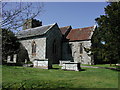
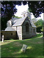
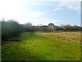
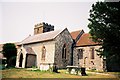
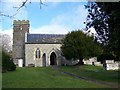
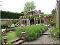
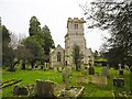
Photos of DT11 9HT


Area Information
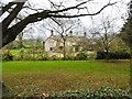
Living in DT11 9HT means being part of a small, tightly knit residential cluster in England. With a population of 2,642 spread across 68 people per square kilometre, the area feels intimate yet functional. This postcode is characterised by its modest scale, where daily life revolves around local amenities and a quiet, stable environment. The community is predominantly composed of adults aged 30–64, reflecting a mature demographic with established routines. While the area lacks the density of larger towns, its compact nature ensures that essential services are within practical reach. Residents benefit from a low crime risk, with a safety score of 88 out of 100, making it a secure place to live. The absence of major environmental constraints, such as protected woodlands or wetlands, means development is unencumbered by planning restrictions. For those seeking a balanced lifestyle, DT11 9HT offers a blend of residential tranquillity and accessible connectivity, though its small size means it is best suited for those prioritising proximity to local essentials over urban vibrancy.
- Area Type
- Postcode
- Area Size
- Not available
- Population
- 2642
- Population Density
- 68 people/km²
The property market in DT11 9HT is shaped by its small size and the predominance of houses. With 45% of residents owning their homes, the area is not heavily reliant on rental demand, though a significant portion of the housing stock is likely available for letting. The focus on houses rather than flats or apartments suggests a market that caters to families or individuals seeking more space. However, the limited number of properties means the area is unlikely to offer a wide range of options for buyers. Those considering the area should be aware that the small scale of DT11 9HT may limit choices, and properties may be in high demand due to the low crime risk and stable environment. For buyers, this means prioritising proximity to local amenities and assessing whether the housing stock aligns with their needs, particularly if they require larger properties or specific layouts.
House Prices in DT11 9HT
No properties found in this postcode.
Energy Efficiency in DT11 9HT
Residents of DT11 9HT have access to a modest selection of retail amenities within practical reach, including Tesco Blandford, M&S Blandford, and Spar. These stores provide essential shopping options, from groceries to general retail, supporting daily convenience. While the data does not mention dining, parks, or leisure facilities, the presence of multiple retail outlets suggests a basic level of commercial activity. The area’s small size means amenities are concentrated, reducing the need for long commutes. However, those seeking more extensive leisure options may need to travel further. The retail offerings reflect a functional, community-focused approach to shopping, ensuring residents can meet their daily needs without significant effort.
Amenities
Schools
The nearest school to DT11 9HT is Downlands Community School, a primary school with an Ofsted rating of satisfactory. This provides families with a local option for early education, though the absence of secondary schools in the immediate area means students may need to travel further for higher-level schooling. The presence of a primary school supports families with young children, offering a foundation for education within walking distance. However, the lack of data on secondary schools or other educational institutions means prospective buyers should investigate additional options beyond the immediate postcode. For those prioritising schools, the mix of school types is limited, and the quality of the primary school should be considered alongside broader educational planning for growing families.
| Rank | School | Type | Entry gender | Ages |
|---|
Explore more schools in this area
Go to Schools tabDemographics
The community in DT11 9HT is predominantly composed of adults aged 30–64, with a median age of 47. This suggests a population that is largely settled, with fewer young families or elderly residents compared to other areas. Home ownership sits at 45%, indicating that nearly half of residents live in properties they own, while the remaining 55% are likely renters. The accommodation type is primarily houses, reflecting a preference for single-family homes over flats or apartments. The predominant ethnic group is White, with no specific data on other demographics provided. The population density of 68 people per square kilometre implies a low-pressure environment, where residents have ample space relative to the number of people. This combination of age profile, ownership levels, and housing stock suggests a community focused on stability and long-term residency, with limited pressure on local infrastructure.
Household Size
Accommodation Type
Tenure
Ethnic Group
Religion
Household Composition
Age
Household Deprivation
NS-SEC
Explore more demographic insights in this area
Go to Demographics tabPlanning
Planning Constraints
- Flood RiskPremium
- Ramsar Wetland SitesPremium
- Area of Outstanding Natural BeautyPremium
- Protected Nature ReservePremium
- Protected WoodlandPremium