Area Overview for DT11 8XZ
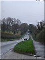
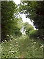
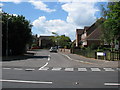
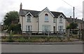
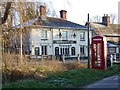
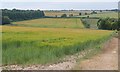
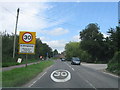
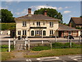
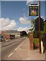
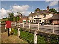
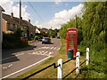
Photos of DT11 8XZ
Area Information
Living in DT11 8XZ means being part of a small, tightly knit residential cluster in England. With a population of 1,972 and a low density of 36 people per square kilometre, this area offers a quiet, uncluttered lifestyle. The community is predominantly composed of adults aged 30–64, many of whom own their homes. This demographic suggests a stable, family-oriented environment where neighbours are likely to know one another. The area’s compact size means amenities and services are within practical reach, though it remains a niche location with limited high-density development. Residents benefit from a low crime risk and minimal environmental constraints, making it a safe and straightforward place to live. For those seeking a slower pace of life, DT11 8XZ provides a contrast to busier urban centres, with a focus on local, community-driven living. The presence of primary schools nearby adds to its appeal for families, while the low population density ensures a sense of space and tranquillity.
- Area Type
- Postcode
- Area Size
- Not available
- Population
- 1972
- Population Density
- 36 people/km²
The property market in DT11 8XZ is dominated by owner-occupied homes, with 75% of properties owned outright. This suggests a stable market where long-term residents are more common than renters. The accommodation type is predominantly houses, which is unusual for areas with higher population densities. This likely reflects the area’s semi-rural or suburban character, with larger properties spread out over a wider area. For buyers, this means a focus on individual homes rather than apartments or flats. The small size of the area means the housing stock is limited, and the immediate surroundings may offer few alternatives. Those seeking a property here are likely to find a family-friendly environment with established homes, though the market may lack the diversity of options found in larger towns or cities.
House Prices in DT11 8XZ
No properties found in this postcode.
Energy Efficiency in DT11 8XZ
The lifestyle in DT11 8XZ is shaped by its proximity to retail amenities, with five notable venues within practical reach. These include Lidl Blandford, Budgens Blandford, and The Southern Co-operative Co, offering a range of shopping and grocery options. This density of retail outlets provides convenience for daily errands, reducing the need for long trips to larger towns. While the data does not mention dining or leisure facilities, the presence of multiple shops suggests a functional, community-focused environment. The area’s low population density means these amenities serve a smaller, local population, fostering a sense of familiarity. For residents, the combination of nearby shops and a quiet setting creates a balance between accessibility and tranquillity, ideal for those prioritising convenience without urban bustle.
Amenities
Schools
The nearest schools to DT11 8XZ include Pimperne Church of England VC Primary School, listed twice in the data. This indicates a single primary school serving the area, likely catering to local children. As a Church of England school, it may follow a faith-based curriculum, though no Ofsted rating is provided. The presence of a primary school is a key factor for families, offering a local education option without the need for long commutes. However, the data does not mention secondary schools or other educational institutions, meaning parents may need to look further afield for comprehensive schooling. The single primary school suggests a limited range of educational choices, which could be a consideration for families prioritising school diversity.
| Rank | School | Type | Entry gender | Ages |
|---|
Explore more schools in this area
Go to Schools tabDemographics
The population of DT11 8XZ is 1,972, with a median age of 47. This indicates a mature community, with the majority of residents falling within the 30–64 age range. Home ownership is high, at 75%, suggesting a stable, long-term resident base. The accommodation type is predominantly houses, reflecting a suburban or semi-rural character. The predominant ethnic group is White, though no further breakdown of diversity is provided. The age profile suggests a mix of middle-aged professionals and families, with fewer young people or retirees. The low population density of 36 people per square kilometre reinforces the area’s quiet, spread-out nature. With no data on deprivation levels, it is unclear how this affects access to services, but the high home ownership and age demographics imply a relatively affluent, settled community.
Household Size
Accommodation Type
Tenure
Ethnic Group
Religion
Household Composition
Age
Household Deprivation
NS-SEC
Explore more demographic insights in this area
Go to Demographics tabPlanning
Planning Constraints
- Flood RiskPremium
- Ramsar Wetland SitesPremium
- Area of Outstanding Natural BeautyPremium
- Protected Nature ReservePremium
- Protected WoodlandPremium