Area Overview for DT11 8XD
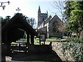
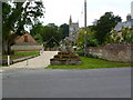
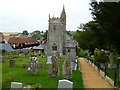
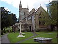
Photos of DT11 8XD
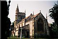
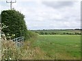
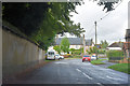
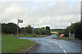

Area Information
Living in DT11 8XD means inhabiting a small, tightly knit residential cluster in England’s rural south. With a population of 1,972 and a low density of 36 people per square kilometre, this area offers a quiet, spaced-out lifestyle. The community is predominantly composed of adults aged 30–64, with a median age of 47, suggesting a stable, mature demographic. Most residents own their homes—75% of properties are owner-occupied—indicating a settled population. The area is characterised by its housing stock, which is largely composed of houses rather than flats, contributing to a sense of privacy and space. Proximity to Pimperne Church of England VC Primary School ensures families have access to local education, while nearby retail amenities like Lidl Blandford and Budgens Blandford provide essential services. DT11 8XD’s low crime risk and minimal environmental constraints make it an appealing choice for those seeking safety and a slower pace of life, without sacrificing practical connectivity.
- Area Type
- Postcode
- Area Size
- Not available
- Population
- 1972
- Population Density
- 36 people/km²
DT11 8XD’s property market is dominated by owner-occupied homes, with 75% of properties owned by residents rather than rented. The accommodation type is exclusively houses, which is unusual for areas with higher population densities but typical of rural or semi-rural settings. This suggests a market geared towards families and individuals seeking spacious, private living without the constraints of urban density. The small size of the area means the housing stock is limited, potentially making it a competitive market for buyers. The absence of flats or apartments indicates a lack of high-density development, which may appeal to those prioritising outdoor space and lower neighbourly proximity. For buyers, this means a focus on individual properties rather than shared or rental options, with the potential for long-term value retention in a stable, low-risk environment.
House Prices in DT11 8XD
No properties found in this postcode.
Energy Efficiency in DT11 8XD
Daily life in DT11 8XD is shaped by its proximity to practical amenities, including five retail outlets such as Lidl Blandford, Budgens Blandford, and The Southern Co-operative Co. These stores provide access to groceries, household goods, and other essentials, reducing the need for long trips to larger towns. The area’s low population density means these amenities serve a relatively small catchment, creating a tight-knit commercial hub. While the data does not mention dining or leisure options, the presence of multiple retail outlets suggests a community that values convenience and local commerce. The lack of detailed information on parks or recreational spaces means residents may need to travel further for outdoor activities, though the area’s low environmental constraints imply minimal restrictions on such pursuits.
Amenities
Schools
The nearest schools to DT11 8XD are both Pimperne Church of England VC Primary School, a primary school serving the local community. While the data lists the same institution twice, it underscores the area’s reliance on a single primary education provider. This may indicate a small catchment area with limited school choice, which could be a consideration for families seeking diverse educational options. The presence of a Church of England school suggests a community with religious or cultural ties to the institution, though no Ofsted ratings are provided in the data. For parents, the proximity of a primary school is a key advantage, though further research would be needed to assess academic performance or availability of secondary education in the vicinity.
| Rank | School | Type | Entry gender | Ages |
|---|
Explore more schools in this area
Go to Schools tabDemographics
The community in DT11 8XD is defined by its mature age profile, with a median age of 47 and the majority of residents falling within the 30–64 age range. This suggests a population that is largely established in careers and family life, contributing to a stable social fabric. Home ownership is high at 75%, indicating a preference for long-term residency over rental living. The accommodation type is predominantly houses, which aligns with the area’s low population density and rural character. The predominant ethnic group is White, reflecting the broader demographic trends of the region. While specific data on deprivation is not provided, the high home ownership and low crime risk suggest a relatively affluent and secure environment. The absence of significant diversity data does not imply a lack of inclusivity but rather highlights the need for further local studies.
Household Size
Accommodation Type
Tenure
Ethnic Group
Religion
Household Composition
Age
Household Deprivation
NS-SEC
Explore more demographic insights in this area
Go to Demographics tabPlanning
Planning Constraints
- Flood RiskPremium
- Ramsar Wetland SitesPremium
- Area of Outstanding Natural BeautyPremium
- Protected Nature ReservePremium
- Protected WoodlandPremium