Area Overview for DT11 8TQ
Photos of DT11 8TQ

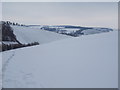
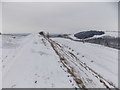
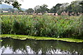
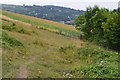
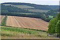
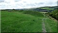
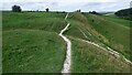
22 photos from this area
Area Information
Key information about the DT11 8TQ including its size, population, and administrative classification.
- Area Type
- Postcode
- Area Size
- 1.4 km²
- Population
- 1798
- Population Density
- 73 people/km²
House Prices in DT11 8TQ
42
Properties
£412,310
Average Sold Price
£95,500
Lowest Price
£725,000
Highest Price
Showing 42 properties
| Address | Type | Beds | Baths | Last Sale Price | Last Sale Date | |
|---|---|---|---|---|---|---|
| Meadowcroft, Manor Road, Stourpaine, DT11 8TQ | Bungalow | 4 | 2 | £525,000 | Sep 2024 | |
| Brook Cottage, 41 Manor Road, Stourpaine, DT11 8TQ | Semi-detached | 3 | 3 | £440,000 | May 2024 | |
| Bucklers Mead, Manor Road, Stourpaine, DT11 8TQ | Bungalow | - | - | £450,000 | Dec 2022 | |
| 12 Manor Road, Stourpaine, DT11 8TQ | Terraced | 3 | - | £420,000 | Aug 2022 | |
| 3, Havelins Barns, Manor Road, Stourpaine, DT11 8TQ | house | - | - | £662,000 | Oct 2021 | |
| Mead House, Manor Road, Stourpaine, DT11 8TQ | house | - | - | £499,000 | Aug 2021 | |
| 13 Manor Road, Stourpaine, DT11 8TQ | Detached | 3 | 2 | £527,000 | Mar 2021 | |
| The Dairy House, Manor Road, Stourpaine, DT11 8TQ | house | - | - | £445,000 | Mar 2021 | |
| Parsonage Farm, Manor Road, Stourpaine, DT11 8TQ | Detached | 4 | 1 | £575,000 | Feb 2020 | |
| 43 Manor Road, Stourpaine, DT11 8TQ | house | 3 | 1 | £330,000 | Aug 2019 |
Page 1 of 5
Energy Efficiency in DT11 8TQ
Amenities
Schools
| Rank | School | Type | Entry gender | Ages |
|---|
Explore more schools in this area
Go to Schools tabDemographics
Household Size
Two person
most common
Accommodation Type
Houses
most common
Tenure
65
majority
Ethnic Group
White
most common
Religion
N/A
most common
Household Composition
N/A
most common
Age
47
median
Adults (30-64 years)
most common
Household Deprivation
N/A
with no deprivation
NS-SEC
36
in Lower managerial occupations
Explore more demographic insights in this area
Go to Demographics tabPlanning
Planning Constraints
- Flood RiskPremium
- Ramsar Wetland SitesPremium
- Area of Outstanding Natural BeautyPremium
- Protected Nature ReservePremium
- Protected WoodlandPremium