Area Overview for DT11 0JT
Photos of DT11 0JT
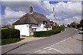
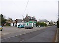
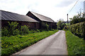
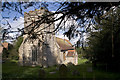
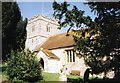
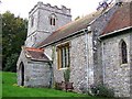
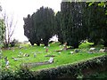
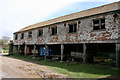
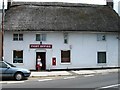
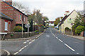
53 photos from this area
Area Information
Key information about the DT11 0JT including its size, population, and administrative classification.
- Area Type
- Postcode
- Area Size
- 3.8 hectares
- Population
- 1430
- Population Density
- 84 people/km²
House Prices in DT11 0JT
22
Properties
£217,000
Average Sold Price
£67,000
Lowest Price
£375,000
Highest Price
Showing 22 properties
| Address | Type | Beds | Baths | Last Sale Price | Last Sale Date | |
|---|---|---|---|---|---|---|
| 18 Homefield, Milborne St Andrew, DT11 0JT | Semi-detached | 3 | - | £375,000 | Dec 2022 | |
| 4 Homefield, Milborne St Andrew, DT11 0JT | Semi-detached | 3 | 1 | £340,000 | Mar 2021 | |
| 3 Homefield, Milborne St Andrew, DT11 0JT | house | - | - | £240,000 | Jul 2015 | |
| 8 Homefield, Milborne St Andrew, DT11 0JT | Semi-detached | 3 | - | £250,000 | May 2014 | |
| 10 Homefield, Milborne St Andrew, DT11 0JT | Semi-detached | 4 | - | £245,000 | Jul 2013 | |
| 16 Homefield, Milborne St Andrew, DT11 0JT | house | 2 | - | £182,000 | Aug 2010 | |
| 2 Homefield, Milborne St Andrew, DT11 0JT | house | - | - | £166,000 | Jul 2009 | |
| 6 Homefield, Milborne St Andrew, DT11 0JT | house | - | - | £209,000 | Jun 2009 | |
| 14 Homefield, Milborne St Andrew, DT11 0JT | house | - | - | £185,000 | Dec 2008 | |
| 9 Homefield, Milborne St Andrew, DT11 0JT | Semi-detached | - | - | £195,000 | Nov 2007 |
Page 1 of 3
Energy Efficiency in DT11 0JT
Amenities
Schools
| Rank | School | Type | Entry gender | Ages |
|---|
Explore more schools in this area
Go to Schools tabDemographics
Household Size
Two person
most common
Accommodation Type
Houses
most common
Tenure
77
majority
Ethnic Group
White
most common
Religion
N/A
most common
Household Composition
N/A
most common
Age
47
median
Adults (30-64 years)
most common
Household Deprivation
N/A
with no deprivation
NS-SEC
36
in Lower managerial occupations
Explore more demographic insights in this area
Go to Demographics tabPlanning
Planning Constraints
- Flood RiskPremium
- Ramsar Wetland SitesPremium
- Area of Outstanding Natural BeautyPremium
- Protected Nature ReservePremium
- Protected WoodlandPremium