Area Overview for DT11 0JE
Photos of DT11 0JE


Area Information
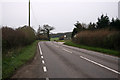
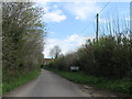
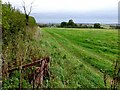
Living in DT11 0JE means being part of a small, tightly knit residential cluster in England. The area covers 12.1 hectares and is home to 1,430 people, with a population density of 84 people per square kilometre. This compact community is characterised by a mix of housing stock, predominantly single-family homes, and a demographic skewed towards adults aged 30–64, with a median age of 47. The area’s small size fosters a quiet, localised feel, where daily life revolves around nearby amenities and a low crime rate. Residents benefit from proximity to Milborne St Andrew First School, which serves both primary and academy needs, and a railway station at Moreton, offering connections to broader networks. While the area is not densely populated, its charm lies in its simplicity—fewer traffic concerns, a slower pace, and a sense of stability. For those seeking a peaceful, low-maintenance lifestyle, DT11 0JE offers a blend of practicality and tranquillity, though its limited size means opportunities for expansion are constrained.
- Area Type
- Postcode
- Area Size
- 12.1 hectares
- Population
- 1430
- Population Density
- 84 people/km²
The property market in DT11 0JE is defined by a high rate of home ownership—77% of residents own their homes—suggesting a stable, long-term community with limited rental activity. The area is dominated by houses, which are the primary accommodation type, indicating a focus on single-family living rather than apartments or shared housing. Given the small size of the area—just 12.1 hectares—housing stock is limited, and the immediate surroundings may offer few additional options for buyers. This scarcity could mean competition for properties, particularly for those seeking specific features. The predominance of owner-occupied homes suggests that the area is not a hotspot for investors or renters, which may appeal to buyers looking for a quiet, low-maintenance environment. However, the small size also means that the local property market is unlikely to offer a wide range of choices, requiring buyers to consider nearby areas for more options.
House Prices in DT11 0JE
No properties found in this postcode.
Energy Efficiency in DT11 0JE
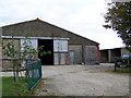
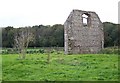
The lifestyle in DT11 0JE is shaped by its proximity to practical amenities and a small-scale community. Nearby retail options include Spar Puddletown, Asda Red, and Co-op Warmwell, providing essential shopping for groceries and daily necessities. These stores cater to the local population, offering convenience without the need to travel far. The Moreton Railway Station adds connectivity, allowing residents to access broader regional services and employment opportunities. While the area lacks large-scale leisure facilities or parks, the absence of environmental constraints such as protected woodlands or AONB designations suggests a lack of restrictions on development or outdoor activities. The character of the area is defined by its simplicity—few traffic concerns, a quiet environment, and a focus on local needs. For those valuing self-sufficiency and proximity to basic amenities, DT11 0JE offers a straightforward, no-frills lifestyle.
Amenities
Schools
Residents of DT11 0JE have access to Milborne St Andrew First School, which serves as both a primary school and an academy. This dual designation suggests a range of educational approaches, though the specific curriculum or Ofsted rating is not detailed in the data. The presence of a primary school within practical reach is a key consideration for families, ensuring children have access to early education without long commutes. The academy designation may indicate a focus on specialist subjects or independent governance, though the exact implications are unclear. For parents, the availability of a local school reduces the need for additional transport costs or reliance on distant institutions. However, the absence of secondary schools or further education facilities in the immediate area means families may need to look beyond DT11 0JE for comprehensive schooling, which could be a factor in long-term housing decisions.
| Rank | School | Type | Entry gender | Ages |
|---|
Explore more schools in this area
Go to Schools tabDemographics
The community in DT11 0JE is predominantly composed of adults aged 30–64, with a median age of 47. This suggests a mature population, likely settled in long-term homes, reflected in the 77% home ownership rate. The area is largely occupied by houses, indicating a preference for family-friendly or traditional housing over flats. Ethnically, the population is predominantly White, with no data provided on other groups. The low population density of 84 people per square kilometre implies a spread-out, less crowded environment. The age profile suggests a stable community with fewer young families or retirees compared to other areas, which may influence local services and amenities. The absence of specific deprivation data means quality of life factors such as access to healthcare or social services are not quantified here, but the low crime rate and lack of environmental constraints suggest a generally secure and untroubled living environment.
Household Size
Accommodation Type
Tenure
Ethnic Group
Religion
Household Composition
Age
Household Deprivation
NS-SEC
Explore more demographic insights in this area
Go to Demographics tabPlanning
Planning Constraints
- Flood RiskPremium
- Ramsar Wetland SitesPremium
- Area of Outstanding Natural BeautyPremium
- Protected Nature ReservePremium
- Protected WoodlandPremium