Area Overview for DT11 0DF
Photos of DT11 0DF
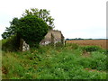
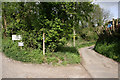
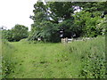
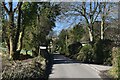
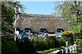
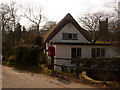
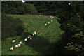
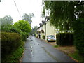
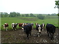
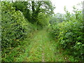
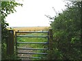
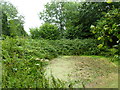
16 photos from this area
Area Information
Key information about the DT11 0DF including its size, population, and administrative classification.
- Area Type
- Postcode
- Area Size
- 27.0 hectares
- Population
- 1208
- Population Density
- 40 people/km²
House Prices in DT11 0DF
19
Properties
£368,452
Average Sold Price
£187,000
Lowest Price
£521,150
Highest Price
Showing 19 properties
| Address | Type | Beds | Baths | Last Sale Price | Last Sale Date | |
|---|---|---|---|---|---|---|
| Upknapp Cottage, The Knapp, Hilton, DT11 0DF | Semi-detached | 3 | 2 | £412,500 | Jul 2023 | |
| Hillview, The Knapp, Hilton, DT11 0DF | house | - | - | £377,500 | Aug 2021 | |
| Raymond Cottage, The Knapp, Hilton, DT11 0DF | house | - | - | £187,000 | Mar 2020 | |
| Holly House, The Knapp, Hilton, DT11 0DF | house | - | - | £427,560 | Jul 2018 | |
| Knapp Cottage, The Knapp, Hilton, DT11 0DF | Detached | 2 | 2 | £285,000 | Jul 2010 | |
| Flintcomb Cottage, The Knapp, Hilton, DT11 0DF | Detached | - | - | £521,150 | Sep 2006 | |
| 3, Knapp Lane, The Knapp, Hilton, DT11 0DF | Detached | 3 | 1 | - | - | |
| Church View, The Knapp, Hilton, DT11 0DF | Detached | 4 | 2 | - | - | |
| Greenacre, The Knapp, Hilton, DT11 0DF | house | 4 | - | - | - | |
| Glenwood, The Knapp, Hilton, DT11 0DF | Semi-detached | 2 | - | - | - |
Page 1 of 2
Energy Efficiency in DT11 0DF
Amenities
Schools
| Rank | School | Type | Entry gender | Ages |
|---|
Explore more schools in this area
Go to Schools tabDemographics
Household Size
Two person
most common
Accommodation Type
Houses
most common
Tenure
69
majority
Ethnic Group
White
most common
Religion
N/A
most common
Household Composition
N/A
most common
Age
47
median
Adults (30-64 years)
most common
Household Deprivation
N/A
with no deprivation
NS-SEC
39
in Lower managerial occupations
Explore more demographic insights in this area
Go to Demographics tabPlanning
Planning Constraints
- Flood RiskPremium
- Ramsar Wetland SitesPremium
- Area of Outstanding Natural BeautyPremium
- Protected Nature ReservePremium
- Protected WoodlandPremium