Area Overview for DT10 2FF
Photos of DT10 2FF
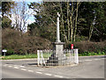
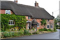
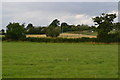
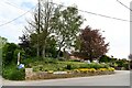
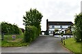
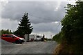
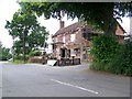
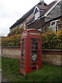
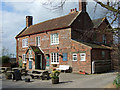
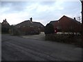
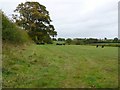
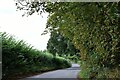
17 photos from this area
Area Information
Key information about the DT10 2FF including its size, population, and administrative classification.
- Area Type
- Postcode
- Area Size
- 7.8 hectares
- Population
- 1980
- Population Density
- 41 people/km²
House Prices in DT10 2FF
12
Properties
£689,167
Average Sold Price
£635,000
Lowest Price
£757,500
Highest Price
Showing 12 properties
| Address | Type | Beds | Baths | Last Sale Price | Last Sale Date | |
|---|---|---|---|---|---|---|
| Meads Cottage, Drum Lane, Wonston, Hazelbury Bryan, DT10 2FF | Detached | 4 | 2 | £675,000 | Sep 2025 | |
| Bloomsbury, Drum Lane, Wonston, Hazelbury Bryan, DT10 2FF | Detached | 4 | 3 | £635,000 | Jul 2025 | |
| Tea Kettle House, Drum Lane, Wonston, Hazelbury Bryan, DT10 2FF | Detached | 5 | 3 | £757,500 | Apr 2024 | |
| Ivanhoe House, Drum Lane, Wonston, Hazelbury Bryan, DT10 2FF | Detached | 4 | 2 | - | - | |
| Corbyns, Drum Lane, Wonston, Hazelbury Bryan, DT10 2FF | Detached | 4 | 3 | - | - | |
| Greenacre, Drum Lane, Wonston, Hazelbury Bryan, DT10 2FF | Detached | - | - | - | - | |
| Springfield, Drum Lane, Wonston, Hazelbury Bryan, DT10 2FF | Detached | - | - | - | - | |
| The Meadows, Drum Lane, Wonston, Hazelbury Bryan, DT10 2FF | Detached | - | - | - | - | |
| Foxgloves, Drum Lane, Wonston, Hazelbury Bryan, DT10 2FF | Detached | - | - | - | - | |
| The Drum And Monkey, Drum Lane, Wonston, Hazelbury Bryan, DT10 2FF | house | - | - | - | - |
Page 1 of 2
Energy Efficiency in DT10 2FF
Amenities
Schools
| Rank | School | Type | Entry gender | Ages |
|---|
Explore more schools in this area
Go to Schools tabDemographics
Household Size
Two person
most common
Accommodation Type
Houses
most common
Tenure
77
majority
Ethnic Group
White
most common
Religion
N/A
most common
Household Composition
N/A
most common
Age
47
median
Adults (30-64 years)
most common
Household Deprivation
N/A
with no deprivation
NS-SEC
38
in Lower managerial occupations
Explore more demographic insights in this area
Go to Demographics tabPlanning
Planning Constraints
- Flood RiskPremium
- Ramsar Wetland SitesPremium
- Area of Outstanding Natural BeautyPremium
- Protected Nature ReservePremium
- Protected WoodlandPremium