Area Overview for DT10 2DB
Photos of DT10 2DB
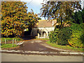
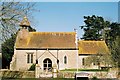
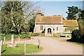
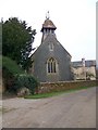
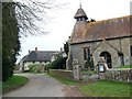

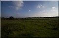

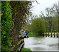
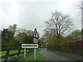
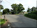
50 photos from this area
Area Information
Key information about the DT10 2DB including its size, population, and administrative classification.
- Area Type
- Postcode
- Area Size
- 1.5 km²
- Population
- 1318
- Population Density
- 150 people/km²
House Prices in DT10 2DB
17
Properties
£758,579
Average Sold Price
£105,000
Lowest Price
£3,000,055
Highest Price
Showing 17 properties
| Address | Type | Beds | Baths | Last Sale Price | Last Sale Date | |
|---|---|---|---|---|---|---|
| Forget Me Not Cottage, Ham Lane, Hammoon, DT10 2DB | house | - | - | £560,000 | Jul 2022 | |
| Hammoon House, The Cross To Bridge Over River Stour Lane, Hammoon, DT10 2DB | Detached | 4 | - | £3,000,055 | Oct 2021 | |
| Keepers Cottage, Ham Lane, Hammoon, DT10 2DB | Semi-detached | 4 | 3 | £350,000 | Jun 2019 | |
| Gale Cottage, The Cross, Hammoon, DT10 2DB | house | - | - | £665,000 | Sep 2013 | |
| Little Glebe, Ham Lane, Hammoon, DT10 2DB | Semi-detached | 3 | 1 | £282,500 | Sep 2006 | |
| North Cottage, 3 Ham Lane, Hammoon, DT10 2DB | Semi-detached | - | - | £105,000 | Feb 2001 | |
| Moyons House, The Cross, Hammoon, DT10 2DB | house | - | - | £347,500 | Aug 1995 | |
| The Manor House, The Cross, Hammoon, DT10 2DB | Detached | 6 | 3 | - | - | |
| Firefly House, The Cross To Bridge Over River Stour Lane, Hammoon, DT10 2DB | Detached | - | - | - | - | |
| The Poplars, Ham Lane, Hammoon, DT10 2DB | Bungalow | - | - | - | - |
Page 1 of 2
Energy Efficiency in DT10 2DB
Amenities
Schools
| Rank | School | Type | Entry gender | Ages |
|---|
Explore more schools in this area
Go to Schools tabDemographics
Household Size
Family (3-5 people)
most common
Accommodation Type
Houses
most common
Tenure
63
majority
Ethnic Group
White
most common
Religion
N/A
most common
Household Composition
N/A
most common
Age
47
median
Adults (30-64 years)
most common
Household Deprivation
N/A
with no deprivation
NS-SEC
24
in Lower managerial occupations
Explore more demographic insights in this area
Go to Demographics tabPlanning
Planning Constraints
- Flood RiskPremium
- Ramsar Wetland SitesPremium
- Area of Outstanding Natural BeautyPremium
- Protected Nature ReservePremium
- Protected WoodlandPremium