Area Overview for DT10 1HT
Photos of DT10 1HT
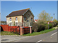
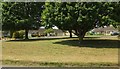
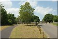
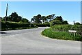
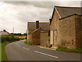
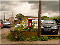
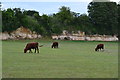
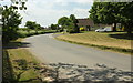
12 photos from this area
Area Information
Key information about the DT10 1HT including its size, population, and administrative classification.
- Area Type
- Postcode
- Area Size
- 8.5 hectares
- Population
- 1852
- Population Density
- 51 people/km²
House Prices in DT10 1HT
9
Properties
£407,042
Average Sold Price
£177,500
Lowest Price
£725,000
Highest Price
Showing 9 properties
| Address | Type | Beds | Baths | Last Sale Price | Last Sale Date | |
|---|---|---|---|---|---|---|
| Old School House, Red Lane, Todber, DT10 1HT | Detached | 5 | 4 | £417,710 | Aug 2023 | |
| 20 Red Lane, Todber, DT10 1HT | Land | 5 | 4 | £485,000 | Feb 2023 | |
| Field View, Red Lane, Todber, DT10 1HT | Land | - | - | £230,000 | Oct 2017 | |
| Woodlands, Red Lane, Todber, DT10 1HT | Detached | 5 | 4 | £725,000 | Oct 2017 | |
| Redlands Cottage, Red Lane, Todber, DT10 1HT | Detached | 5 | 4 | £177,500 | Jun 1998 | |
| Plot A, Red Lane, Todber, DT10 1HT | Detached | 5 | 4 | - | - | |
| Old School Hall, Red Lane, Todber, DT10 1HT | Semi-detached | 2 | 1 | - | - | |
| Shredlands, Red Lane, Todber, DT10 1HT | Bungalow | - | - | - | - | |
| The Gables, Red Lane, Todber, DT10 1HT | house | - | - | - | - |
Energy Efficiency in DT10 1HT
Amenities
Schools
| Rank | School | Type | Entry gender | Ages |
|---|
Explore more schools in this area
Go to Schools tabDemographics
Household Size
Two person
most common
Accommodation Type
Houses
most common
Tenure
82
majority
Ethnic Group
White
most common
Religion
N/A
most common
Household Composition
N/A
most common
Age
47
median
Adults (30-64 years)
most common
Household Deprivation
N/A
with no deprivation
NS-SEC
37
in Lower managerial occupations
Explore more demographic insights in this area
Go to Demographics tabPlanning
Planning Constraints
- Flood RiskPremium
- Ramsar Wetland SitesPremium
- Area of Outstanding Natural BeautyPremium
- Protected Nature ReservePremium
- Protected WoodlandPremium