Area Overview for DT10 1DF
Photos of DT10 1DF
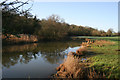
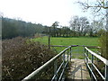
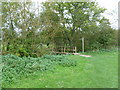
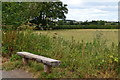


24 photos from this area
Area Information
Key information about the DT10 1DF including its size, population, and administrative classification.
- Area Type
- Postcode
- Area Size
- 7.7 hectares
- Population
- 2193
- Population Density
- 102 people/km²
House Prices in DT10 1DF
15
Properties
£372,929
Average Sold Price
£183,000
Lowest Price
£798,000
Highest Price
Showing 15 properties
| Address | Type | Beds | Baths | Last Sale Price | Last Sale Date | |
|---|---|---|---|---|---|---|
| The Old Dairy House, Penny Street, Sturminster Newton, DT10 1DF | house | 4 | - | £798,000 | Jun 2021 | |
| Tanyard Paddock, Penny Street, Sturminster Newton, DT10 1DF | Bungalow | 2 | - | £325,000 | Oct 2014 | |
| Orcadia Cottage, Penny Street, Sturminster Newton, DT10 1DF | Cottage | 2 | 1 | £183,000 | Jul 2014 | |
| Carrann Cottage, Penny Street, Sturminster Newton, DT10 1DF | house | 3 | - | £297,000 | Jun 2011 | |
| Meadowside, Penny Street, Sturminster Newton, DT10 1DF | house | 2 | - | £247,500 | Jul 2010 | |
| Hamgate Farm House, Penny Street, Sturminster Newton, DT10 1DF | Detached | - | - | £485,000 | Jul 2006 | |
| Ulwell, Penny Street, Sturminster Newton, DT10 1DF | Semi-detached | 3 | 1 | £275,000 | Dec 2003 | |
| Foriers, Penny Street, Sturminster Newton, DT10 1DF | Bungalow | 4 | 2 | - | - | |
| The Nook, Penny Street, Sturminster Newton, DT10 1DF | Terraced | - | - | - | - | |
| Tanyard Corner, Penny Street, Sturminster Newton, DT10 1DF | Detached | - | - | - | - |
Page 1 of 2
Energy Efficiency in DT10 1DF
Amenities
Schools
| Rank | School | Type | Entry gender | Ages |
|---|
Explore more schools in this area
Go to Schools tabDemographics
Household Size
Two person
most common
Accommodation Type
Houses
most common
Tenure
79
majority
Ethnic Group
White
most common
Religion
N/A
most common
Household Composition
N/A
most common
Age
47
median
Adults (30-64 years)
most common
Household Deprivation
N/A
with no deprivation
NS-SEC
33
in Lower managerial occupations
Explore more demographic insights in this area
Go to Demographics tabPlanning
Planning Constraints
- Flood RiskPremium
- Ramsar Wetland SitesPremium
- Area of Outstanding Natural BeautyPremium
- Protected Nature ReservePremium
- Protected WoodlandPremium