Area Overview for Downend and Bromley Heath
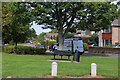
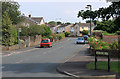
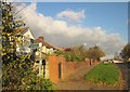
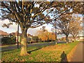
Photos of Downend and Bromley Heath
Area Information
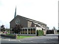
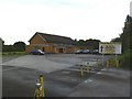
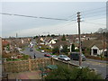
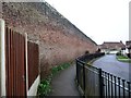
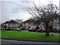
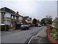
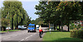
Downend and Bromley Heath is a civil parish located in South Gloucestershire within South West England. You will find this community centred around the BS16 5DD postcode area, spanning a total of 2.9 km². The location acts as a bridge between rural history and modern suburbia, bounded directly by the M4 motorway and the local ring road. This transport infrastructure defines the daily rhythm of life here, offering quick access to broader networks while maintaining a distinct residential character. The area grew from an agricultural settlement into a thriving suburb following the post-World War Two era. Significant housing developments from the 1950s and 1960s transformed former farmland into the homes you see today. While the fabric of the neighbourhood has changed, it retains historic elements such as the bottom of Britannia Wood and old farmhouses. You can still visit the W.G. Grace Memorial Pavilion at the cricket ground or explore the Christ Church, which dates back to 1831. Living in Downend and Bromley Heath means enjoying a layout that balances quiet village greens with reliable connectivity to Bristol and the wider region.
- Area Type
- Parish
- Area Size
- 2.9 km²
- Population
- Not available
- Population Density
- Not available
Demographics
The community profile of Downend and Bromley Heath is defined by a mature population. The median age for residents is exactly 70 years old. This figure indicates that a significant portion of the household composition consists of older adults compared to national averages. You will find that 85% of residents own their homes outright or through mortgages. This high level of home ownership suggests a stable community where long-term residents have established roots in the parish. Accommodation types and ethnic groups are recorded in the data as totals, reflecting the standard demographic recording methods for the full population. Religion is also recorded as a total category for the wider parish council data. The area is not characterised by specific sub-groups but rather presents a unified residential block. With almost nine out of ten homes owner-occupied, the local dynamic focuses on stability rather than the transient nature of a letting market. The household structure supports a lifestyle where residents are likely invested in the long-term improvement of their specific properties.
Household Size
Accommodation Type
Tenure
Ethnic Group
Religion
Household Composition
Age
Household Deprivation
NS-SEC
Explore more demographic insights in this area
Go to Demographics tabPlanning
Planning Constraints
- Flood RiskPremium
- Ramsar Wetland SitesPremium
- Area of Outstanding Natural BeautyPremium
- Protected Nature ReservePremium
- Protected WoodlandPremium
- Crime RiskPremium